
What Is Georeferencing? Principles, Methods and Applications.
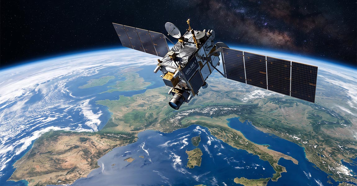
Learn what georeferencing is, how coordinate systems and ground control points work, and how UAV LiDAR direct georeferencing produces accurate Point Clouds.
Georeferencing is the process of assigning real-world coordinates to spatial data. It underpins nearly every map, satellite image, and 3D Point Cloud used in surveying and GIS today. Without it, aerial imagery and survey datasets carry no connection to the ground beneath them.
This article covers what georeferencing is, the principles behind it, the methods professionals use to accomplish it, and the applications where it matters most. You will also learn how georeferencing connects to UAV LiDAR workflows and why integrated systems from YellowScan depend on precise georeferencing to deliver survey-grade Point Clouds.
Key Takeaways: Georeferencing
- Georeferencing ties spatial data to real-world coordinates so it can be placed accurately on a map or in a GIS.
- Coordinate reference systems and datums provide the mathematical framework that makes georeferencing consistent across datasets.
- Ground control points serve as known reference locations that anchor imagery or Point Cloud data to the earth’s surface.
- Direct georeferencing with GNSS and IMU sensors eliminates the need for ground control for manual georeferencing.
- YellowScan UAV LiDAR systems integrate GNSS and IMU hardware to produce georeferenced Point Clouds immediately after data acquisition.
What Is Georeferencing?
Georeferencing is the act of linking a dataset, such as a raster image, scanned map, or Point Cloud, to a specific location on the earth’s surface using a defined coordinate system. The result is data that can be layered with other geospatial information, measured, and analyzed in the correct geographic position.
Consider a satellite photograph of a city. On its own, it shows buildings, roads, and parks. It carries no information about where those features sit on the planet.
Georeferencing assigns geographic coordinates such as latitude, longitude, and sometimes elevation values to the pixels or points in that dataset, fixing it in place.
How Georeferencing Connects Data to Real-World Coordinates
The connection between raw data and real-world coordinates happens through a transformation. A mathematical model maps pixel or point positions in the dataset to corresponding positions in a geographic or projected coordinate system.
For raster imagery, this typically involves identifying clear and visible objects in a shared location (e.g., road markings or corners of hard structures) between the image and a reference dataset, and then computing the transformation that aligns them. For LiDAR Point Clouds, georeferencing is often built into the acquisition process itself, with onboard sensors recording precise positions for every laser return.
Why Georeferencing Matters in GIS and Surveying
Accurate georeferencing ensures that multiple datasets collected at different times, from different sensors, or by different teams can be combined in a single coordinate framework. A topographic survey, an aerial photograph, and a utility map only become useful together when each dataset occupies the correct geographic position.
In surveying, georeferencing also determines the positional accuracy of the final deliverable. When the reference data or the transformation process introduces errors, every measurement derived from that dataset inherits those errors.
What Are the Core Principles of Georeferencing?
Two foundational concepts support every georeferencing workflow: coordinate reference systems (including datums) and ground control points. Understanding both is essential before working with any geospatial data.
What Are Coordinate Systems and Datums?
A coordinate reference system (CRS) defines how positions on the earth are represented numerically. Geographic coordinate systems express location as latitude and longitude on a reference ellipsoid – The mathematical model used to approximate the Earth’s curved shape. Projected coordinate systems convert those positions onto a flat plane, which is necessary for printed maps and GIS analyses.
A datum defines how a reference ellipsoid (the Earth’s mathematical shape) is positioned and oriented relative to the Earth, and a CRS relies on this datum to express coordinates. WGS 84, for example, is the datum used by GPS receivers worldwide. Regional datums such as NAD 83 in North America or GDA2020 in Australia are optimized for local accuracy.
Choosing the correct datum and CRS is a critical first step. Conflating them introduces positional shifts that can range from centimeters to hundreds of meters.
What Role Do Ground Control Points Play?
Ground control points (GCPs) are identifiable locations on the earth’s surface whose coordinates have been measured with high accuracy, typically using survey-grade GNSS equipment. During georeferencing, these known positions serve as anchors that tie the dataset to the real world.
In aerial photogrammetry, operators place physical targets on the ground before a flight and then match those targets to their positions in the imagery. In aerial LiDAR workflows, GCPs can be used to georeference the point cloud, while independent checkpoints are used to assess its data quality/precision.
According to the U.S. Geological Survey, ground control points remain a foundational element of positional accuracy assessment for satellite and aerial imagery programs.
What Methods Are Used for Georeferencing?
Georeferencing methods fall into two broad categories: stereopreparation, which relies on reference points identified and measured after data collection, and direct georeferencing, which uses position and orientation information recorded during acquisition. The choice depends on the sensor, the platform, and the accuracy requirements of the project.
How Manual and Automated Georeferencing Differ
Manual georeferencing involves an operator selecting tie points between the raw dataset and a reference source, such as an existing orthoimage or a set of GCPs. GIS software then computes the transformation that best fits those tie points. This approach is common when working with scanned historical maps, unreferenced aerial photographs, or legacy datasets that lack embedded position data.
Automated georeferencing uses algorithms to detect and match features between overlapping images or between a dataset and a reference database. Modern photogrammetry software applies this technique at scale, processing thousands of images with minimal manual intervention. The accuracy of automated methods depends on the quality and distribution of the matched features.
How GNSS, IMU, and LiDAR Support Direct Georeferencing
Direct georeferencing eliminates the post-collection tie-point step by recording the position and orientation of the sensor at the moment each measurement is captured. This is the standard approach for UAV LiDAR mapping.
A GNSS receiver on the aircraft determines position. An inertial measurement unit (IMU) tracks orientation (roll, pitch, and heading). The LiDAR scanner records range and angle for each laser pulse. Combining these three data streams, the processing software assigns accurate coordinates to every point in the resulting Point Cloud.
YellowScan UAV LiDAR systems integrate GNSS and IMU hardware directly into each unit. This integrated design means the Point Cloud produced by a system like the YellowScan Mapper+ or the YellowScan Voyager is georeferenced from the start.
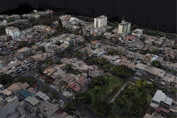
Example of a LiDAR point cloud acquired with a YellowScan LiDAR system
What Are Common Applications of Georeferencing?
Georeferencing applies across a wide range of disciplines. It is required wherever spatial data needs to be placed in a real-world coordinate framework.
Topographic surveying: Georeferenced Point Clouds and digital elevation models underpin civil engineering design, construction monitoring, and volume calculations.
Environmental monitoring: Researchers georeference aerial and satellite imagery to track coastal erosion, deforestation, and habitat changes over time. Repeated surveys of the same area require consistent georeferencing so that differences between datasets reflect actual changes on the ground.
Infrastructure inspection: Utilities and transportation agencies rely on georeferenced corridor maps to manage power lines, pipelines, roads, and railways. The YellowScan Surveyor Ultra, for instance, is designed for corridor and linear infrastructure mapping, delivering precise georeferenced data along extended routes. For infrastructure inspection, systems such as the YellowScan Mapper Ultra and YellowScan Voyager provide detailed georeferenced data that can support the inspection and assessment of assets.
Archaeology and heritage preservation: LiDAR-based georeferenced surveys have revealed buried structures beneath dense vegetation at sites around the world. Documented examples include Mayan ruins in Mexico and historical sites in the Indian Ocean.
What Is the Difference Between Georeferencing and Orthorectification?
Georeferencing and orthorectification are related but distinct processes. Georeferencing assigns coordinate information to a dataset. orthorectification goes a step further by correcting geometric distortions caused by terrain relief and camera tilt, producing an image with uniform scale.
Georeferencing and orthorectification are related but distinct processes. Georeferencing assigns geographic coordinates to a dataset, whether it consists of LiDAR point clouds or photogrammetric data.
Orthorectification applies to imagery and goes a step further by correcting geometric distortions caused by terrain relief and camera orientation, producing an image with a uniform scale. YellowScan LiDAR systems can also integrate camera modules, enabling both georeferenced point clouds and orthophotos to be generated from a single survey.
An orthorectified image, often called an orthoimage or orthophoto, can be used for direct distance and area measurements because it has been corrected to a true top-down perspective. A georeferenced image that has not been orthorectified may still contain positional shifts in areas with significant elevation change. For flat terrain, the practical difference between the two is small. For mountainous or highly varied landscapes, orthorectification is essential to maintain measurement accuracy.
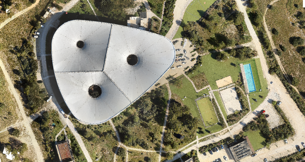
Example of an orthorectified image
In Conclusion: When Georeferencing Becomes Essential
Georeferencing is the foundation that makes spatial data usable. Map overlays, change-detection analyses, and survey-grade deliverables all depend on data being placed in the correct coordinate framework.
For UAV LiDAR professionals, georeferencing is built into the acquisition workflow itself. Systems that integrate GNSS, IMU, and LiDAR sensors, like those designed by YellowScan, produce georeferenced Point Clouds that are ready for analysis and delivery. Thanks to YellowScan CloudStation, you can process, classify, and visualize your georeferenced datasets, providing a seamless workflow from field acquisition to final deliverables.
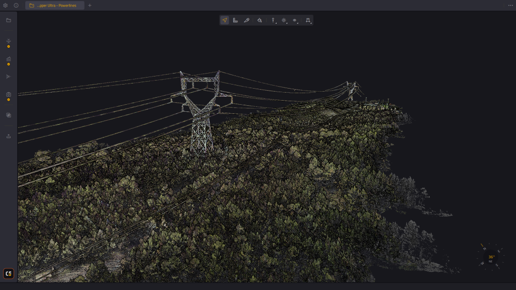
YellowScan CloudStation software for processing, georeferencing, and exporting LiDAR point clouds
FAQs about Georeferencing
What is the simplest definition of georeferencing?
Georeferencing is the process of assigning real-world geographic coordinates to a dataset so that it can be positioned in a defined coordinate system and aligned with data from different sources. It connects images, scans, GIS layers or point clouds to specific locations on the earth’s surface.
Do you need ground control points for UAV LiDAR georeferencing?
Not always. Direct georeferencing uses onboard GNSS and IMU sensors to position each laser measurement during flight. YellowScan UAV LiDAR systems use this approach, producing georeferenced Point Clouds without requiring ground control in many standard survey conditions. Check points, on the other hand, are very useful for quality assessment and data validation.
What happens if georeferencing is inaccurate?
Inaccurate georeferencing causes datasets to appear in the wrong location, making it difficult to overlay them with other maps or survey data. Measurements derived from misaligned data will contain positional errors that can compromise engineering design, environmental analysis, asset management, or change detection.
How does georeferencing differ from geocoding?
Geocoding converts a text-based address into geographic coordinates. Georeferencing aligns an existing spatial dataset, such as imagery or a Point Cloud, to a coordinate reference system. YellowScan systems perform georeferencing by integrating GNSS and IMU data with LiDAR measurements during each mission.
Can georeferencing be applied to historical maps?
Yes. Scanning a historical map and then assigning coordinate values to identifiable features is one of the most common georeferencing tasks in GIS. This allows researchers to compare past and present conditions by overlaying the historical map with modern geospatial datasets.