Understanding LiDAR Scanners

LiDAR scanners are used for capturing 3D point clouds. But how do they work? This and more are explained in the article below, which covers the operating principle of different LiDAR scanners and explains how distance measurements are transformed and combined into 3D point clouds. These provide the basis for many 3D mapping products used for different industry applications.
Introduction to LiDAR scanners
LiDAR technology is a geodata acquisition that has made significant progress over the last 25 years. LiDAR scanners capture 3D point clouds, from which other 3D products are derived. These include 3D city models, triangular irregular networks (TIN), 3D virtual landscapes, Digital Elevation Models (DEMs), and more. These are used for many applications such as flood prevention, road safety improvements, environmental analysis, and many others.
A LiDAR scanner is a device that routinely acquires point clouds of millions or even billions of points during a single survey. LiDAR scanners are “active” sensors that emit laser beams for measuring the distances to objects without human contact with the objects; “active” means that the sensors themselves emit electromagnetic energy. For more information about the different classifications and where LiDAR fits in, refer to this article.
Main types of LiDAR scanners
There are two main types of LiDAR scanners: airborne and terrestrial scanners. Airborne LiDAR scanners make use of a laser device mounted in an aircraft that measures the travel time of laser pulses forth and back. Over the last few years, UAVs or drones have proven to be a reliable technology for capturing 3D geodata. YellowScan specializes in LiDAR systems for drones. For more information on using LiDAR on UAVs, refer to this article.
Static ground-based LiDAR uses a LiDAR scanner that remains at a fixed, stationary position during a scanning project. When a scanning instrument uses a ground-based moving platform, the term “mobile laser scanning” is used.
The terms LiDAR scanner and laser scanners are often used interchangeably, but there’s a subtle difference between the two: LiDAR is a broader term that refers to the use of laser technology to measure distances and is used in various contexts, including airborne and terrestrial applications. The term “laser scanning” often refers specifically to the process of capturing detailed 3D shapes and geometries of objects or environments, typically with terrestrial equipment. So, LiDAR is a broader term than laser scanning, which could also be called “terrestrial LiDAR”.
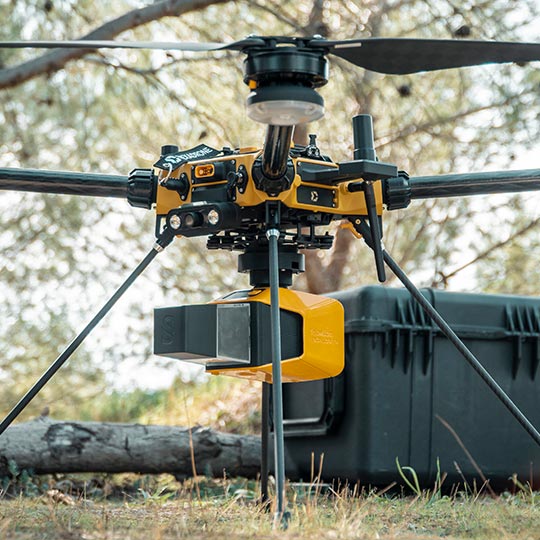
Airborne LiDAR scanner
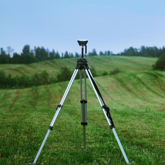
Terrestrial LiDAR scanner
Components of a LiDAR scanner
LiDAR scanners combine scanning optics, a laser pulse emitter, and a receiver. An airborne laser sensor consists of a laser pulse emitter and scanning optics to direct and distribute the laser pulses across the flight path and a receiver. A scanning system combines three components: a LiDAR scanner, a positioning system based on the Global Navigation Satellite System (GNSS), and an inertial navigation system (INS). An INS is also known under the name “inertial measurement unit” (IMU), which enables the determination of the orientation of the sensor concerning a reference system.
A LiDAR scanner’s laser source transmits many laser pulses per second; scanning optics serve to direct and distribute the laser across a flight path (in the case of an airborne LiDAR system). In terrestrial laser scanning, revolving mirrors distribute the laser beams over a scene in a regular, controlled fashion.
Operating principle of LiDAR scanners
A LiDAR scanner’s laser unit produces individual laser pulses or laser beams at high frequencies. To capture a scene, the laser beams have to be distributed in two directions, which are more or less perpendicular to each other. For terrestrial laser scanning, this will usually be the horizontal and vertical directions. Airborne LiDAR works similarly to terrestrial LiDAR but is more demanding as multiple parameters of the exterior orientation have to be determined while the system is moving through the air. For more info on how LiDAR works, refer to this article.
The emitted laser beam from a LiDAR scanner measures the distance to an object that the beam meets first. Apart from the range, the LiDAR scanner registers additional data, including the vertical angle and the horizontal angle of the range. The 3D spherical coordinates are related to the coordinate system of the laser scanning device.
Multiple transformations are applied to move from spherical coordinates to 3D Cartesian X, Y, and Z coordinates related to the laser scanner, and finally a common coordinate system for georeferencing multiple point clouds. Surveying a scene usually requires scans from different set-up positions to cover large objects. Point cloud processing software enables generating of digital elevation models and the creation of 3D models (3D maps) of outdoor and indoor scenes.
Applications of LiDAR Scanners
LiDAR scanners are used for diverse applications across industries, including but not limited to:
- Archeology: LiDAR is used for reconstructing ancient structures, discovering complex patterns, and uncovering clues about civilizations from long ago;
- Mining: LiDAR is used for performing detailed topographic surveys of mining sites, capturing high-resolution elevation data, and detecting even subtle changes in terrain;
- Construction engineering: LiDAR mapping guides construction progress monitoring, clash detection, and site analysis;
- Forestry: airborne LiDAR is used for pollution modeling and to assist carbon absorption estimations;
- Digital City Modeling: 3D point clouds enable the creation of 3D digital twins or virtual replicas of entire cities.
For more information on how LiDAR scanners are used across multiple industries, refer to this article.
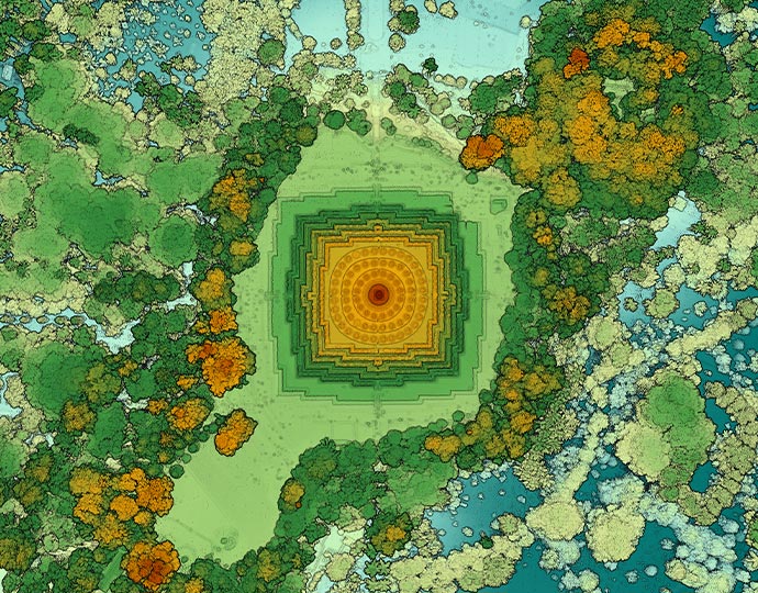
Point cloud from an archaeological project
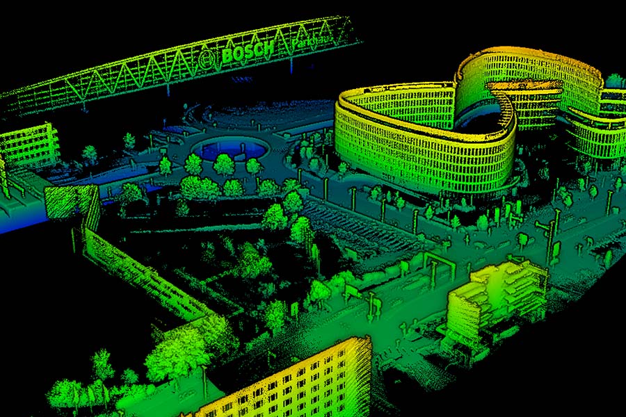
Point cloud for a digital city modeling project
Advantages and limitations of LiDAR scanners
LiDAR is often compared with photogrammetry and radar. Photogrammetry and LiDAR are geodata acquisition technologies for 3D point cloud data. But their methodology to capture and create 3D point clouds is different: where LiDAR uses laser pulses to measure the distance to an object near the scanning device to create 3D point clouds, photogrammetry uses overlapping imagery as the basis for this. Radar uses radio waves that are transmitted from a rotated or fixed antenna and measure the time of flight of the reflected signal.
These are some of the advantages of LiDAR scanners compared to photogrammetry, which is another 3D point cloud acquisition technology, as well as radar:
- LiDAR scanners capture 3D point clouds directly, whereas photogrammetry requires an extra, intermediary step to turn imagery into 3D point clouds;
- LiDAR performs well in the dark as it requires no external light source, which means that data can be captured 24/7;
- LiDAR lends itself better for 3D mapping than radar, due to a higher resolution when compared over a large distance;
- LiDAR is well-suited for complex and irregular objects due to the multiple returns, such as vegetation.
There are also disadvantages to LiDAR scanners compared with other technologies:
- A drawback of LiDAR scanners is errors in the range calculations as a result of laser beams reflecting multiple times before reaching the receiver;
- Occlusions refer to gaps or shadows in 3D point clouds when objects block the view of others;
- LiDAR data volumes are very large, which can require a lot of processing time and computing power from hardware when performing data processing.
For more information on the differences between laser scanning and photogrammetry, refer to this article. For a comparison between radar and LiDAR, refer to this article.
Emerging trends and future outlook on LiDAR scanners
Laser scanning technology has made a lot of progress over the last 25 years. In general, the use of LiDAR scanners is expected to grow as a result of advancing technology and new applications. For example, the ongoing miniaturization of components of devices accompanied by a continuous increase in computer power means that laser sensors are getting more capabilities while simultaneously getting smaller and lighter. More computer power means that more point cloud data is captured and processed in less time, giving way to more applications that use full-waveform LiDAR, which records the entire waveform of a LiDAR pulse’s return instead of just three to five discrete peaks with discrete return LiDAR.
Smaller systems open new applications for drone-based LiDAR, for both indoor and outdoor use. Simultaneous localization and mapping (SLAM) algorithms for positioning and orientation purposes enable indoor laser scanning, including drone-based LiDAR. For capturing water bodies and surrounding areas in 3D, drone-based LiDAR is now a reality. Additionally, the automotive sector is using LiDAR to produce live high-definition (HD) maps for object detection while navigating the car (semi-)autonomously.
Finally, another trend in LiDAR is the adoption of Artificial Intelligence (AI) for feature classification and extraction at the time of data capture. This means that the interpretation of point clouds is left to algorithms, that are trained to do this work quickly and with good results.
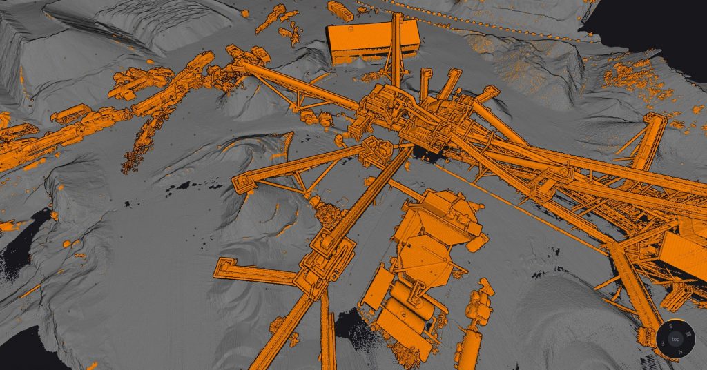
Automatic classification of points as “ground/non-ground” on the YellowScan CloudStation software
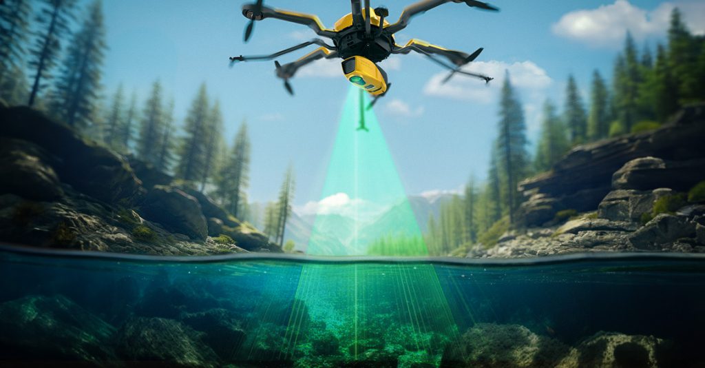
The YellowScan Navigator uses a green laser to penetrate the water
Conclusion
This article describes how LiDAR scanners work. LiDAR scanners are active sensors used to capture accurate and precise 3D point clouds directly, that provide the basis for different derived 3D products. These are used for different applications in industries such as agriculture, mining, mapping, engineering, and archeology. There are two main types of LiDAR scanners: terrestrial and aerial LiDAR scanners. LiDAR scanners contain a laser source that transmits many laser pulses per second, a receiver, and scanning optics. LiDAR has several advantages and disadvantages when compared to radar and photogrammetry, two other 3D data acquisition sources. The future of LiDAR looks bright, with more industry applications being launched as a result of technological advancements that amplify the usability of LiDAR scanners in different user scenarios.
Resources:
“Introduction to Pointcloudmetry: Point Clouds from Laser Scanning and Photogrammetry”, by Matthias Lemmens (Whittles Publishing, 2023)
“Imagery and GIS: Best Practices for Extracting Information from Imagery”, by Kass Green, Russell G. Congalton and Mark Tukman (Esri Press, 2017)
Frequently Asked Questions on LiDAR scanner
What are LiDAR scanners?
LiDAR or laser scanners are active sensors that emit laser beams for measuring the distances to objects without human contact with the objects; “active” means that the sensors themselves emit electromagnetic energy. There are two main types of LiDAR scanners: airborne and terrestrial scanners.
What does a LiDAR scanner do?
A LiDAR scanner routinely acquires point clouds that consist of millions or even billions of points during a single survey. 3D laser scanning is a geodata acquisition technology for 3D city modeling, inspection of roads, railways, and a multitude of other applications.
How do LiDAR scanners work?
A LiDAR scanner contains a laser unit that produces individual laser pulses or laser beams at high frequencies. The distance from the scanner to a target object is measured after a return is registered by the scanner. Next, the measurement data is converted to a 3D point in a common coordinate system through multiple coordinate transformations.
Who invented the first LiDAR scanner?
The first commercial LiDAR was brought to market in 1962 by Theodore Maiman and his team at the Hughes Research Laboratory.
What is the difference between a LiDAR scanner and a laser scanner?
LiDAR is a broader term that refers to the use of laser technology to measure distances and is used in various contexts, including airborne and terrestrial applications. Laser scanning is a narrower definition of this concept, and refers specifically to the process of capturing detailed 3D shapes and geometries of objects or environments, often with terrestrial equipment.