Found 167 Results
Page 1 of 2
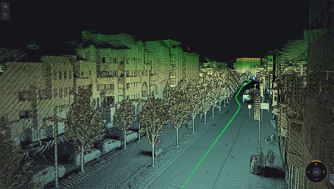
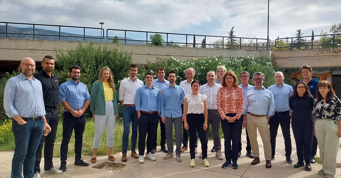
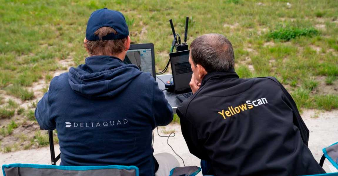
In mid-April, in Aix-en-Provence, something more than a conference took place. For two days, the YellowScan LiDAR Convention brought together over 120 people from across the world, surveyors, engineers, researchers, drone manufacturers, partners. Different roles, different perspectives, but a shared connection to one thing: LiDAR in the real world. And very quickly, something became clear. […]

24 April 2026
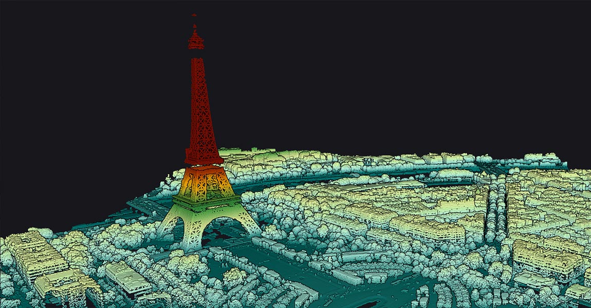
Learn how to measure the Eiffel Tower in just a few minutes using LiDAR technology:In this tutorial, discover how the free YellowScan CloudStation Viewer software allows you to visualize and measure the Eiffel Tower in a 3D environment, thanks to LiDAR technology deployed by IGN as part of the national LiDAR HD program. This exercise […]
30 March 2026
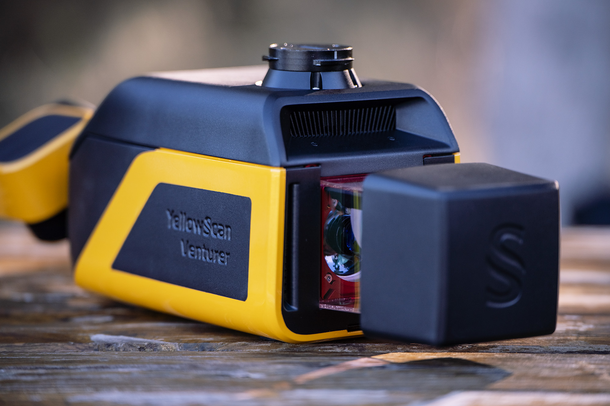
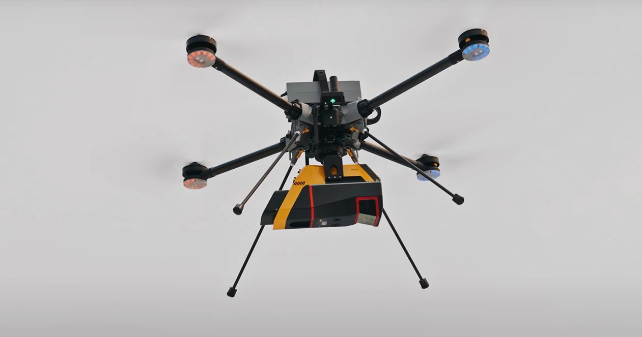
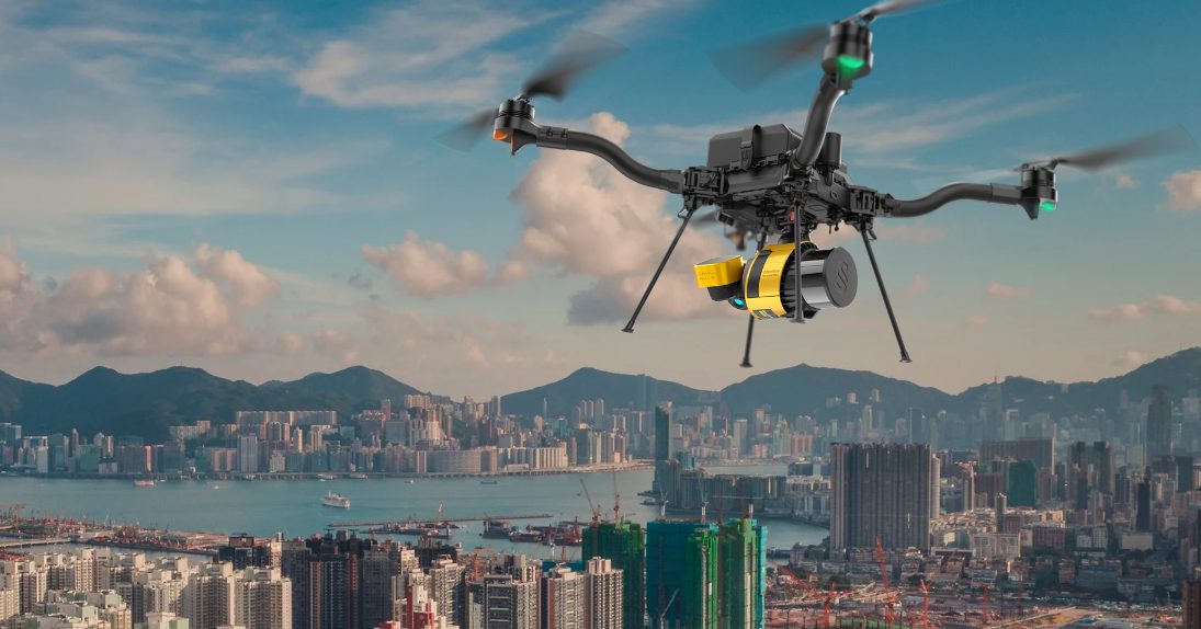
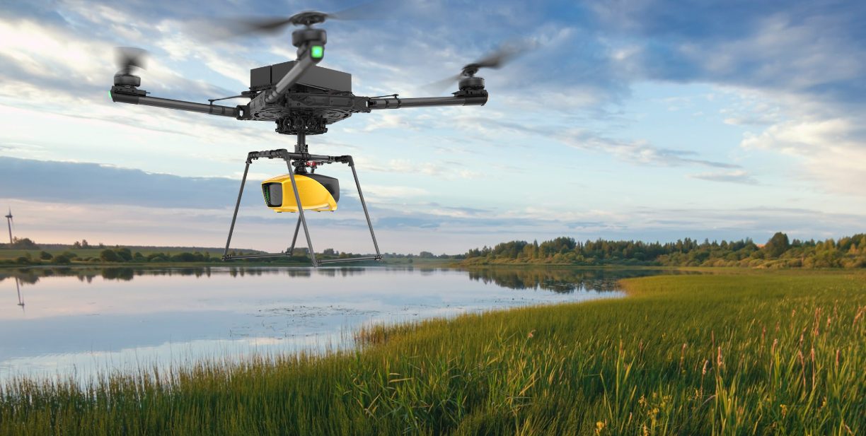
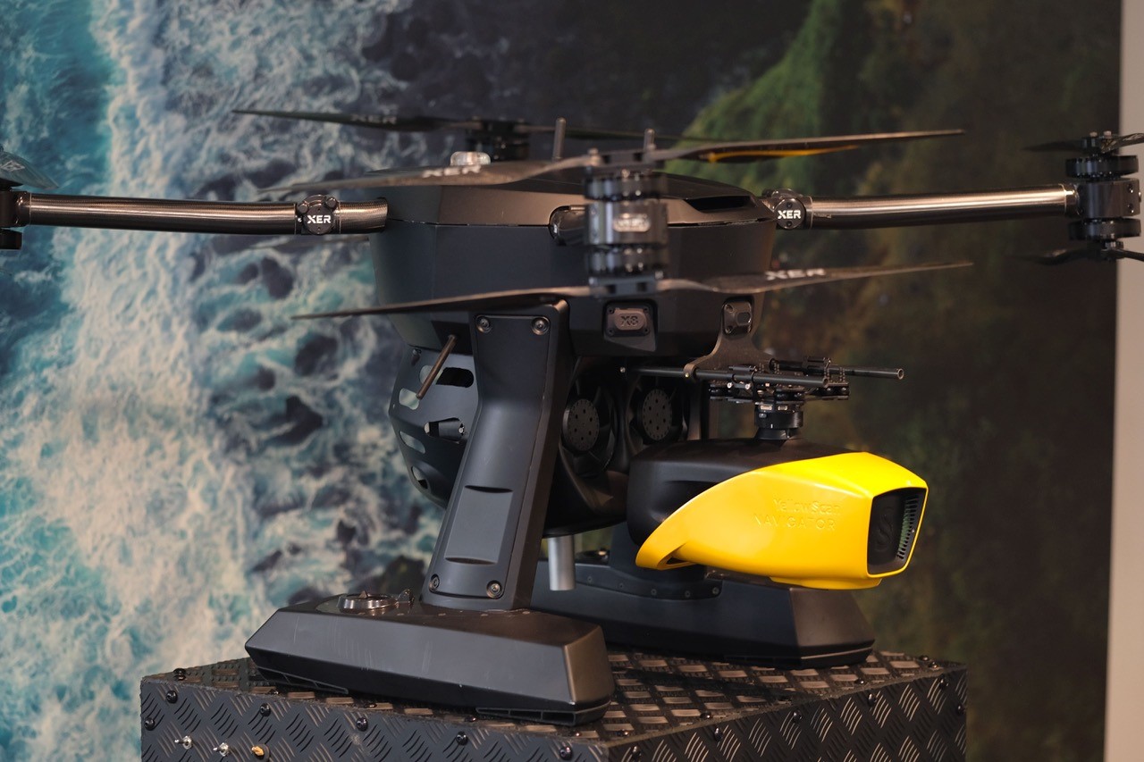
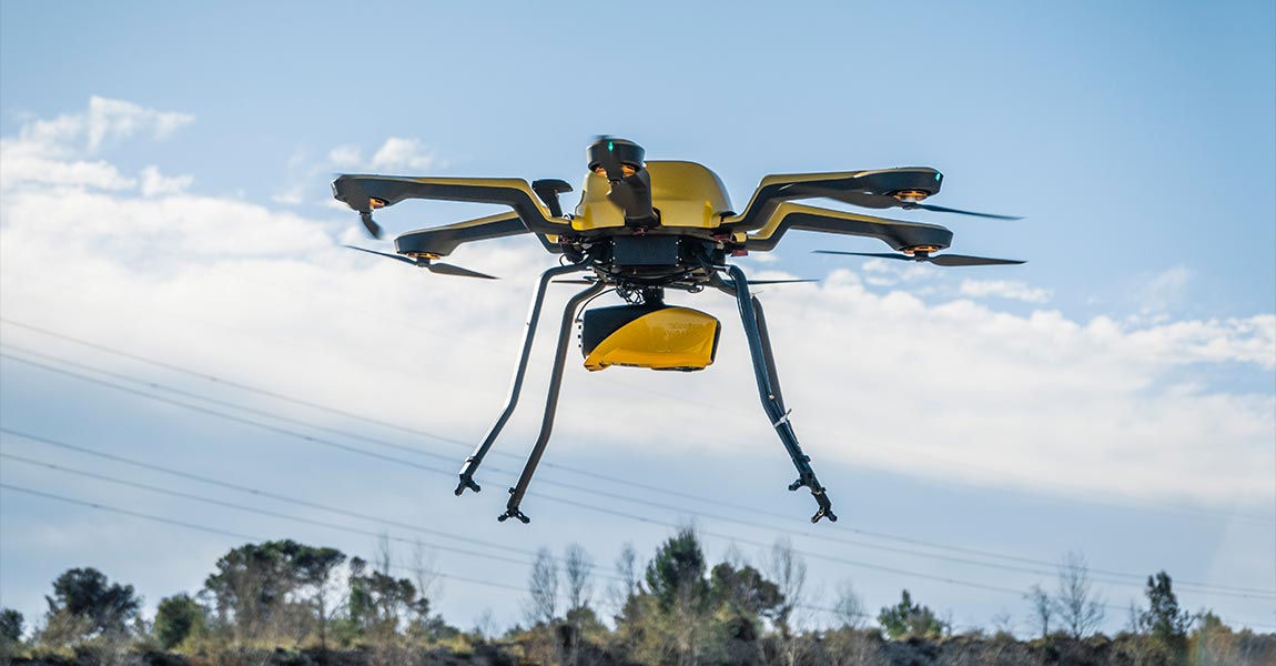
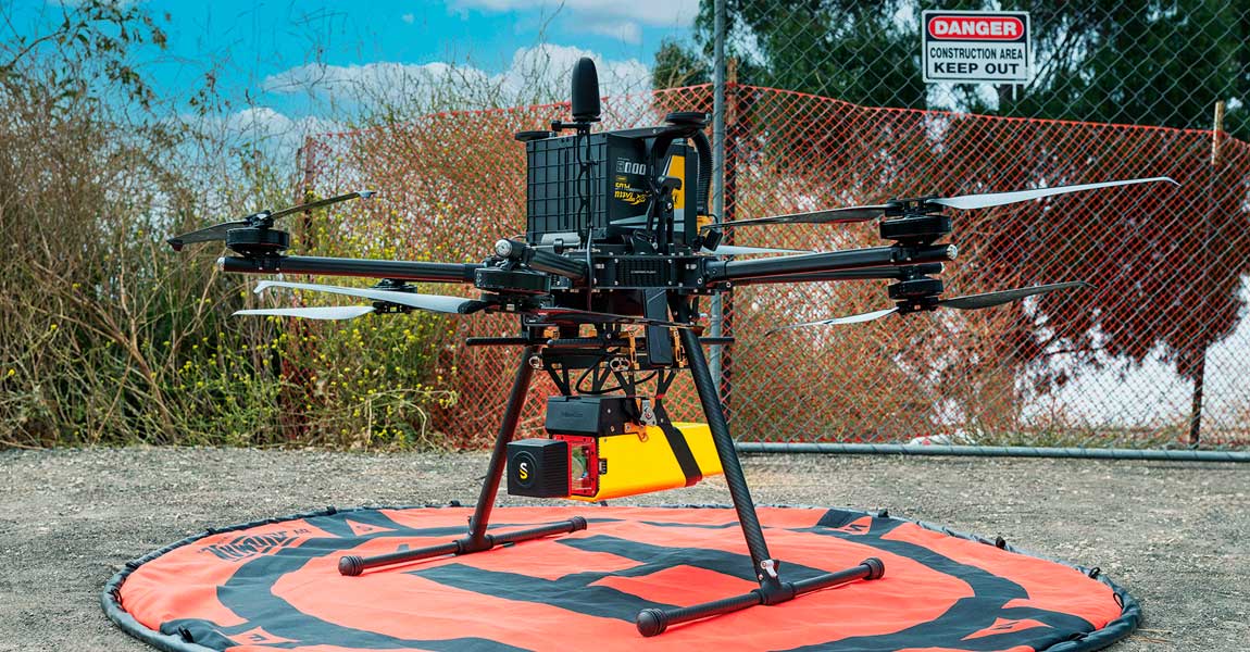
YellowScan Unveiled the Venturer: a government approved LiDAR Solution for high-stakes missions at Geo Week 2026 The YellowScan Venturer, an advanced LiDAR system developed for missions requiring precision, security, and adaptability. This new system was unveiled at GeoWeek 2026 in Denver, Colorado, on February 16-18, 2026. Built for Certainty in Demanding Environments The Venturer is […]
20 February 2026
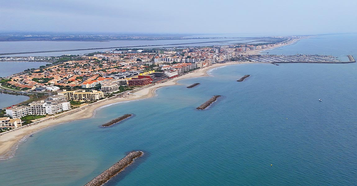
The Mediterranean coastline faces significant ecological and economic challenges. The Gulf of Lion, which has been studied for erosion and flooding risks for over 15 years, exemplifies these issues. The reduced sediment supply from rivers—including the Rhône—flowing into the gulf has intensified coastal erosion, a problem further exacerbated by climate change. Storm Intensity and Coastal […]
5 February 2026
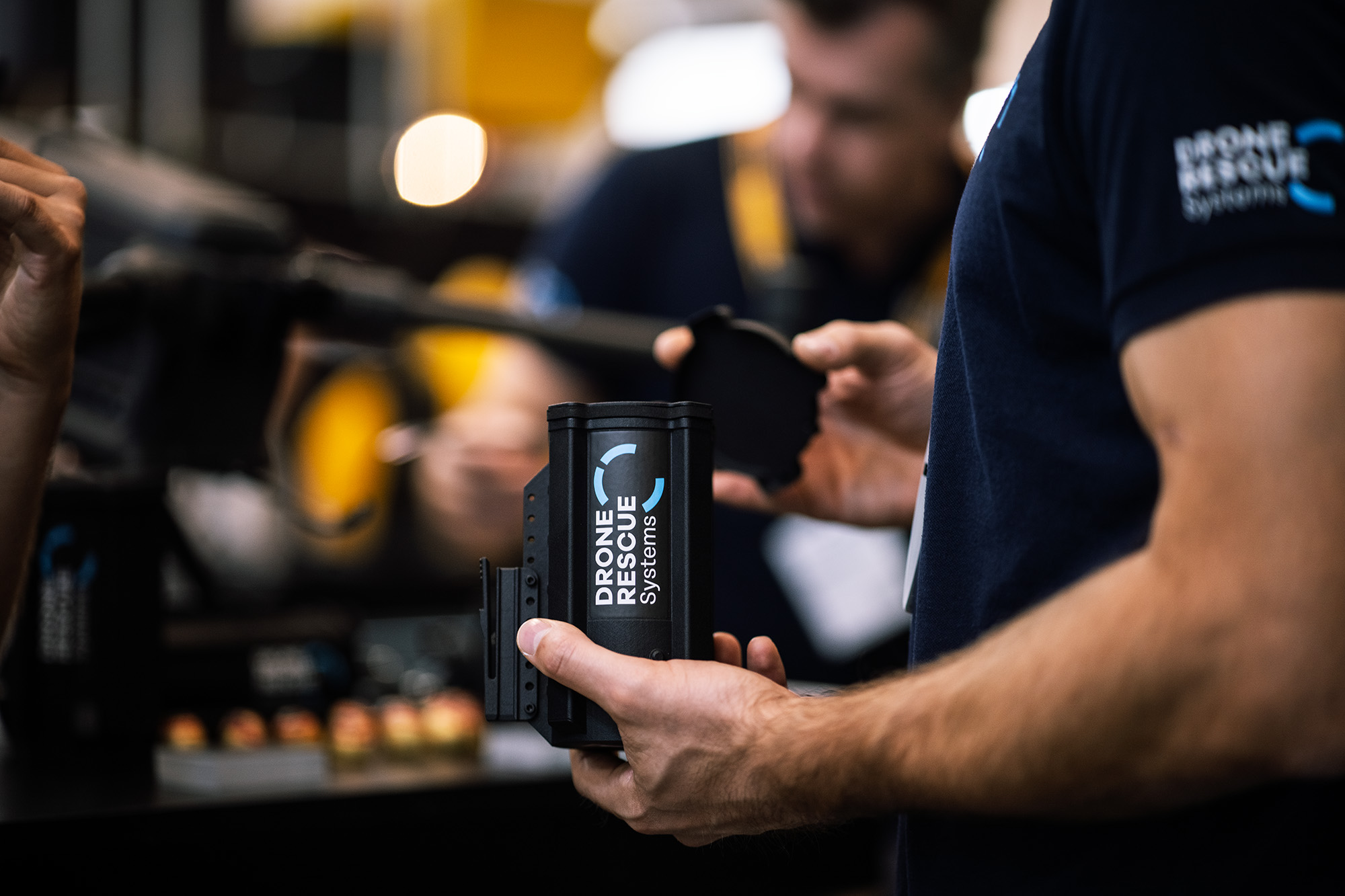
Montpellier, France – 2025, December 18th YellowScan, a global leader in lightweight LiDAR mapping solutions, and Drone Rescue Systems (DRS), a leading provider of drone parachute recovery systems, are proud to announce their collaboration to enhance operational safety and reliability in UAV-based LiDAR missions. Although not directly integrated, the two technologies naturally complement each other […]
18 December 2025
The YellowScan Navigator Bathymetric LiDAR was Showcased at the 5th Edition of the Grande Exposition du Fabriqué en France Initiated by French President Emmanuel Macron, this exhibition celebrated companies and artisans embodying the excellence and craftsmanship of French manufacturing. Out of over 2,500 applications, only 123 companies were selected by a national panel of experts. […]

28 November 2025
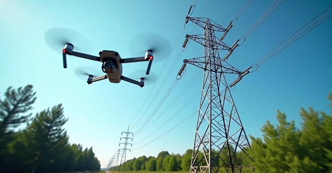
Aerial mapping with drones has revolutionized how utility companies monitor their vast powerline networks. Traditional inspection methods often involved helicopters, ground crews with binoculars, or climbing teams, all expensive, time-consuming, and sometimes dangerous approaches. However, drone technology now offers a safer, more efficient solution for powerline monitoring and vegetation management. These unmanned aircrafts can capture […]
24 November 2025
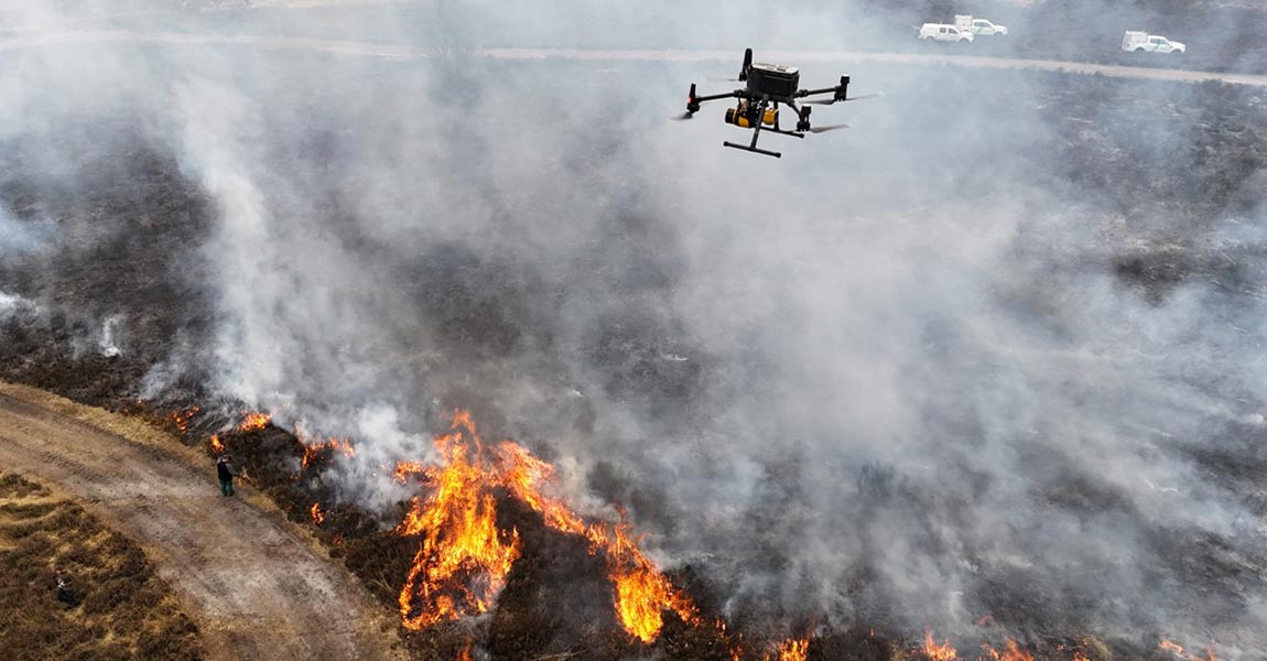
Challenge The research team at PXL University of Applied Sciences and Arts conducted this project as part of a broader effort to develop quantitative methods for estimating fuel types and loads in general and fuel consumption in prescribed burns in particular. Traditional field-based assessments were time-consuming and often imprecise, making it difficult to evaluate fuel […]
Challenge The Norwegian Institute for Water Research (NIVA) is the leading partner of SeaBee, Norway’s infrastructure for drone-based research, mapping, and monitoring in the coastal zone. As part of this initiative, NIVA aimed to study seagrass ecosystems, which capture and store large amounts of CO₂. The goal was to investigate how much carbon is stored […]

10 November 2025
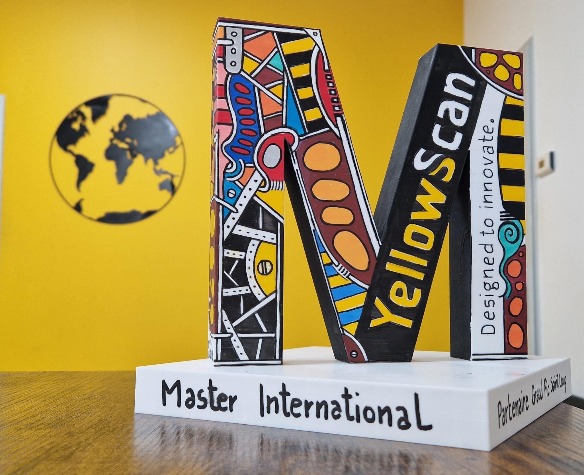
YellowScan receives award from la Lettre M for its international expansion.Montpellier, France – November 3, 2025 – YellowScan, a French leader in LiDAR mapping solutions for drones, YellowScan won an award in the International category at the Occitanie East Entreprise 2025 ceremony, organised by La Lettre M. This recognition highlights YellowScan’s sustained growth and global […]
3 November 2025
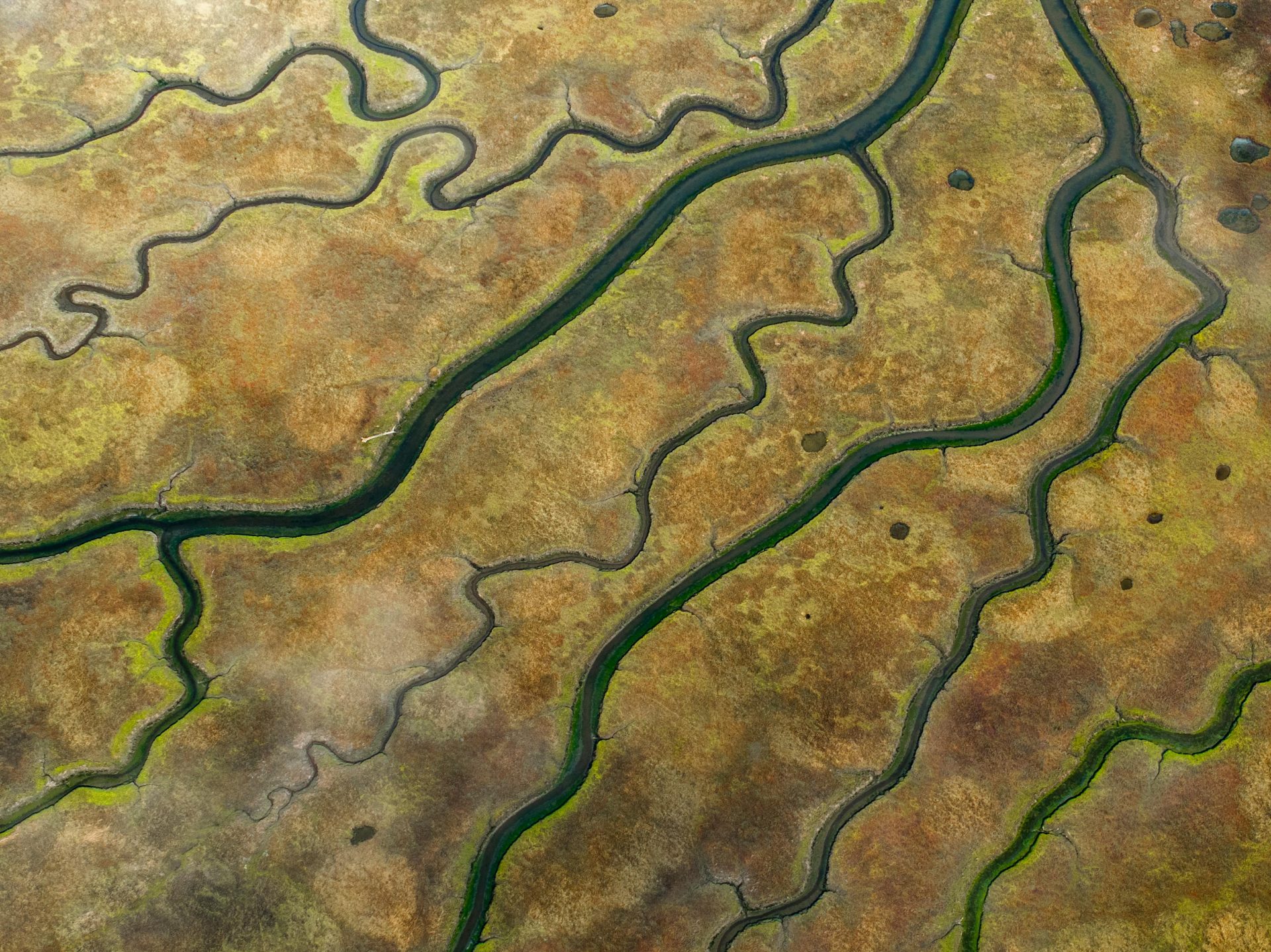
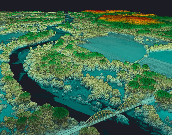
Modeling River Channels and Floodplains Mapping major and minor riverbeds, particularly for river mobility studies, requires various cartographic methods. Topographic LiDAR is ideal for modeling riverbanks with centimeter-level precision and a strong ability to penetrate vegetation. However, it cannot map the submerged part of the riverbed, necessitating a second method to complete the data. Combining […]
31 October 2025
Hero Image for How Weather Really Affects LiDAR Performance LiDAR technology employs light to measure distances with remarkable precision. Short for Light Detection and Ranging, this remote sensing method sends out laser pulses and measures their return time after bouncing off objects. The result creates detailed three-dimensional representations of environments. The principle behind LiDAR remains […]

10 October 2025
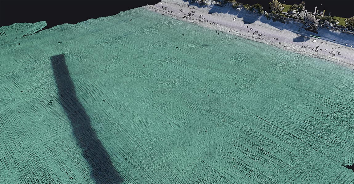
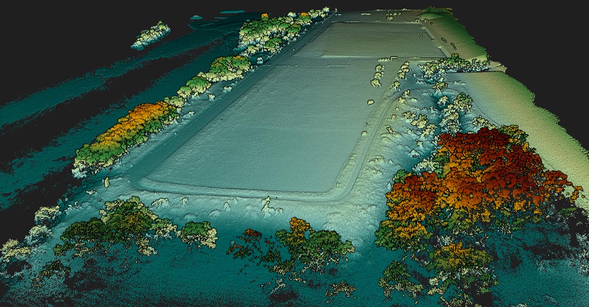
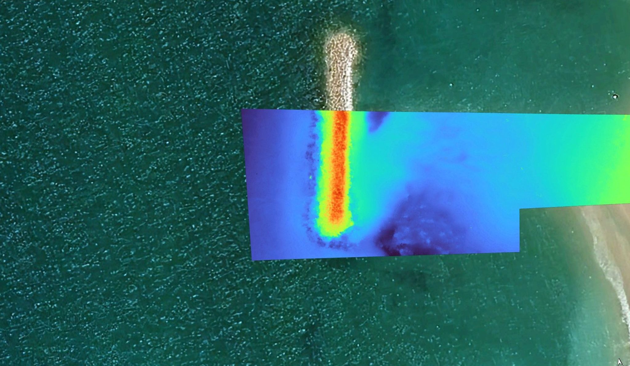
This demo, carried out with our Australian distributor Sphere Drones, aimed to demonstrate that the YellowScan Navigator could be rapidly deployed for efficient and precise coastal mapping, even in challenging public and environmental conditions. The project focused on monitoring an artificial reef located ~200 meters off Port Beach, with an emphasis on real-time usability and […]
9 September 2025
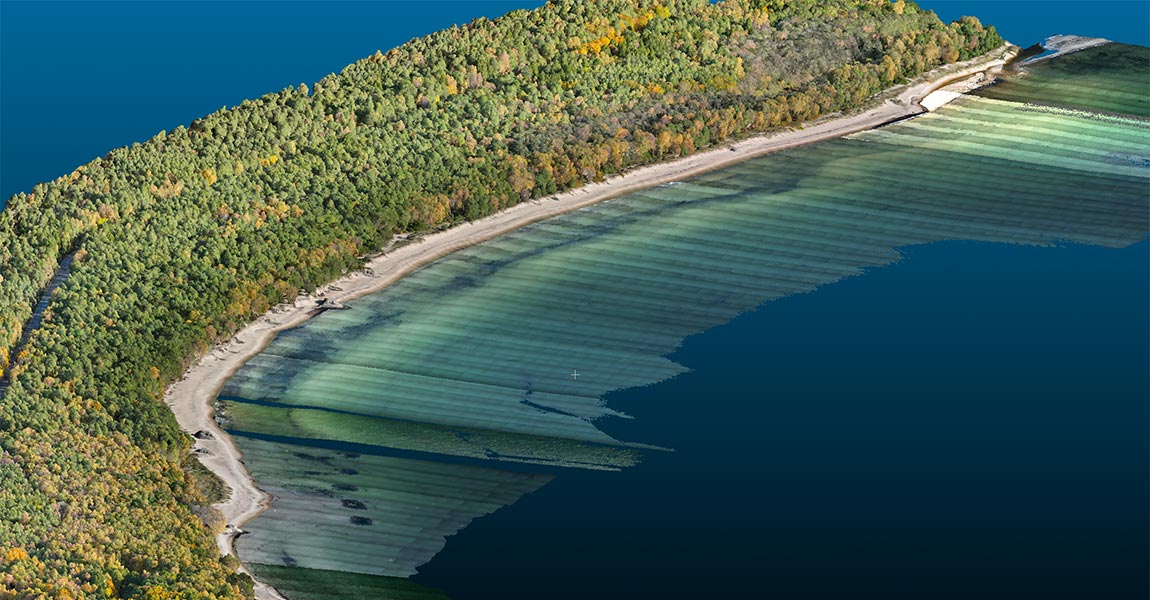
Challenge Located on the southernmost coast of Sweden, Ystad is a popular region known for its shallow sandy beaches and thriving tourism. However, its exposure to strong winds and waves across the Baltic Sea makes it particularly vulnerable to coastal erosion. To understand these natural dynamics, the Ystad Municipality has implemented a long-term coastal monitoring […]
11 August 2025
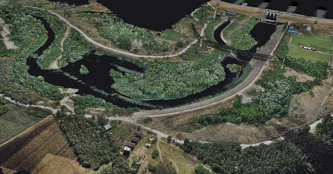
Challenge From coastal erosion to dam monitoring, bathymetric surveys in Romania come with a unique set of environmental and logistical challenges. In the Black Sea, water turbidity is high and GNSS signals are frequently unstable, conditions that typically hinder the accuracy of traditional bathymetric tools. Inland sites such as rivers and dams introduce their own […]
4 August 2025
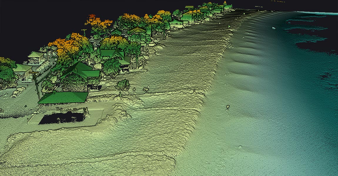
Challenge Along the coast of Maine, USA, communities are facing increasing pressure from storm-driven erosion and rising sea levels. The region is home to sensitive ecosystems, such as habitats for endangered piping plovers, and its economy depends heavily on both tourism and the health of its coastal environment. To respond to these challenges, researchers from […]
31 July 2025
LiDAR (Light Detection and Ranging) serves as the life-blood of modern navigation systems. It provides precise spatial measurements through an elegant yet powerful operational principle. Unlike passive sensing technologies, LiDAR actively emits laser pulses toward objects and measures the reflection time back to the sensor. This time-of-flight measurement helps calculate exact distances using the formula […]
30 July 2025
Light Detection and Ranging (LiDAR) technology powers the “eyes” of autonomous vehicles. LiDAR principle is pretty easy to understand: the system measures how long it takes for laser pulses to bounce off objects and return to the sensor. This simple concept creates detailed 3D maps with exceptional precision – about 0.1 degrees of spatial resolution. […]
23 July 2025
LiDAR accuracy is the life-blood of reliable spatial data acquisition. The basic concept shows how close a LiDAR measurement comes to the actual real-life value. At the time professionals discuss LiDAR accuracy, they express it as a range (±2cm) or as a standard deviation (3cm to 1σ). The LiDAR domain has two main accuracy classifications: […]
9 July 2025
LiDAR technology sends out hundreds of thousands of laser pulses each second. It achieves impressive accuracy between 2.5 and 10 centimeters in surveyed areas. This precision makes it a great way to get data for creating detailed 3D point clouds that serve applications of all types, from geology to urban planning. LiDAR really shines when […]
2 July 2025
In information analysis, measurements, and classification, especially with LiDAR solutions like those from YellowScan, the terms “accuracy” and “precision” are often confused. Although they have distinct meanings, both are essential for evaluating solution performance in fields such as UAV-based LiDAR mapping and machine learning. Understanding their difference is key to interpreting results, setting thresholds, and […]
25 June 2025
Making Sense of Data in a Data-Driven World From Raw Data Overload… We’re surrounded by raw data—from customer clicks online to 3D landscapes captured by laser scanning devices like LiDAR. Every day, vast volumes of information flow from sensors, online sales, customer surveys, or the LiDAR systems YellowScan offers. But raw data doesn’t automatically equate […]
5 June 2025
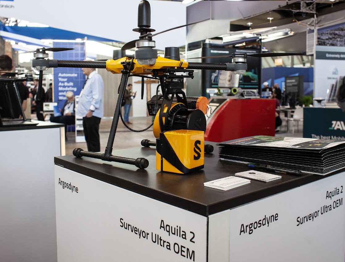
Montpellier, France – May 15th, 2025 – YellowScan, a global leader in UAV LiDAR solutions, and Argosdyne, a leading drone manufacturer, today announced a strategic partnership centered around the EasyMapper drone solutions, which have officially received the prestigious C2 Class certification from the European Union Aviation Safety Agency (EASA). C2 Classification Achievement Marks Major Milestone […]
16 May 2025
Challenge Enso Geospatial and LIA Engineering and Survey LTD. have been working together for years to improve shallow water mapping and deliver top-tier results to their clients. Over time, they’ve tested various green wave LiDAR sensors in their search for better data quality, higher point density, safer, flexible and more efficient survey methods. For this […]
12 May 2025
UK drone LiDAR specialist Aetha to demonstrate YellowScan Navigator technology at premier ocean technology event. Montpellier, France – April 8th, 2025 – YellowScan, a global leader in drone LiDAR solutions, in partnership with UK distributor Aetha, will exhibit at Ocean Business 2025, taking place April 8-10. This premier event offers a unique opportunity for professionals […]

8 April 2025
Challenge For over three years, MOST Robotics, the YellowScan distributor for the DACH region, has collaborated with Clear Timber, a Dutch forestry inspection company, on various forest mapping projects. During this time, they have utilized a range of LiDAR systems including the YellowScan Mapper version 2, Mapper version 3, Vx20-300, Surveyor Ultra version 2, Surveyor […]
4 February 2025
This article covers LiDAR in the context of capturing topography data. We’ll explain why LiDAR is a game-changer for capturing topography, and describe the different applications and industries benefitting from it. Finally, we’ll cover the different tools and methods to capture LiDAR topography and describe future trends. Why is LiDAR a Game-Changer for Topography? A […]
17 December 2024
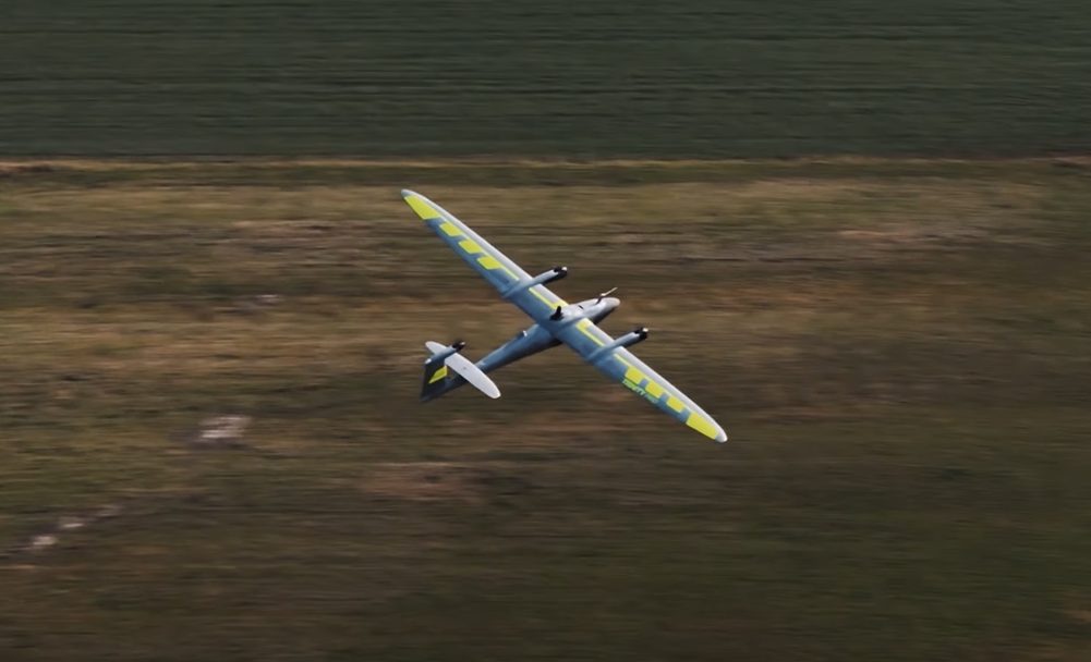
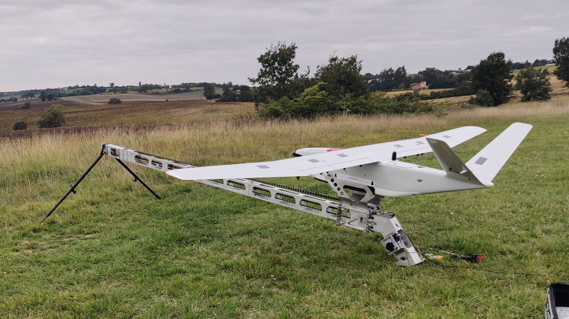
December 12th, Montpellier – A breakthrough in unmanned aerial vehicle (UAV) technology has been achieved with the introduction of a new integration between an innovative LiDAR system and a cutting-edge drone featuring the revolutionary tailsitter VTOL design. Developed by a team of experienced UAV engineers, this advanced solution brings an unprecedented level of accuracy, efficiency, […]
12 December 2024
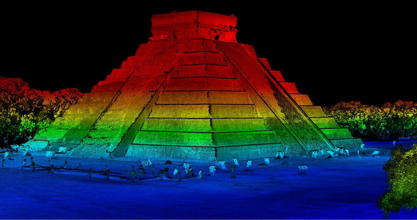
Challenge Our Mexican distributor, Geoearth held several meetings with the Mexican federal government, which led to a project aimed at searching for possible archaeological remains within the protected area of Chichen Itza. Geoearth conducted some studies to search for archaeological remains using traditional methods and flights with a drone, to obtain precise and verifiable results. […]
26 November 2024
This article covers remote sensing and its applications. We’ll explain what is the difference between active and passive remote sensing, and cover the different technologies and platforms used for remote sensing. Finally, we’ll have a look at recent and future developments of remote sensing. What is Remote Sensing? Remote sensing means obtaining information about […]

7 November 2024
Challenge National Forestry organization approached OR3D GEO to assess landslide risks within a large woodland In North Wales. Terrain instability and erosion are common in this area, where dense vegetation and challenging terrain have made traditional surveying methods ineffective for collecting accurate elevation data and monitoring ground movement. A key challenge was getting accurate elevation […]
October 31st, 2024, Montpellier and Seoul – YellowScan is thrilled to announce an exciting collaboration with Argosdyne, whose latest UAV has officially received the C2 Class certification. This recognition marks a new chapter in the delivery of highly accurate, safe, and efficient aerial LiDAR services, now capable of reaching new environments and applications. Through this […]
5 November 2024
Discover how to use the YellowScan Mapper Plus for LiDAR data processing, from flight trajectory correction to creating surface models. To find out more, watch the video above. Discover our UAV LiDAR Solutions Find out more
17 October 2024
Discover YellowScan’s new Navigator LiDAR system, designed to generate bathymetric data and map shallow waters from a drone. To find out more, watch the video above. Discover our UAV LiDAR Solutions Find out more
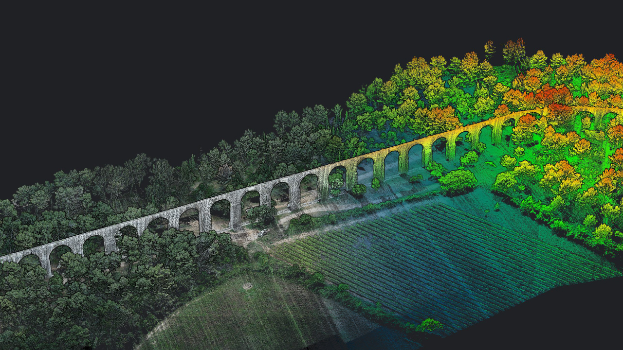
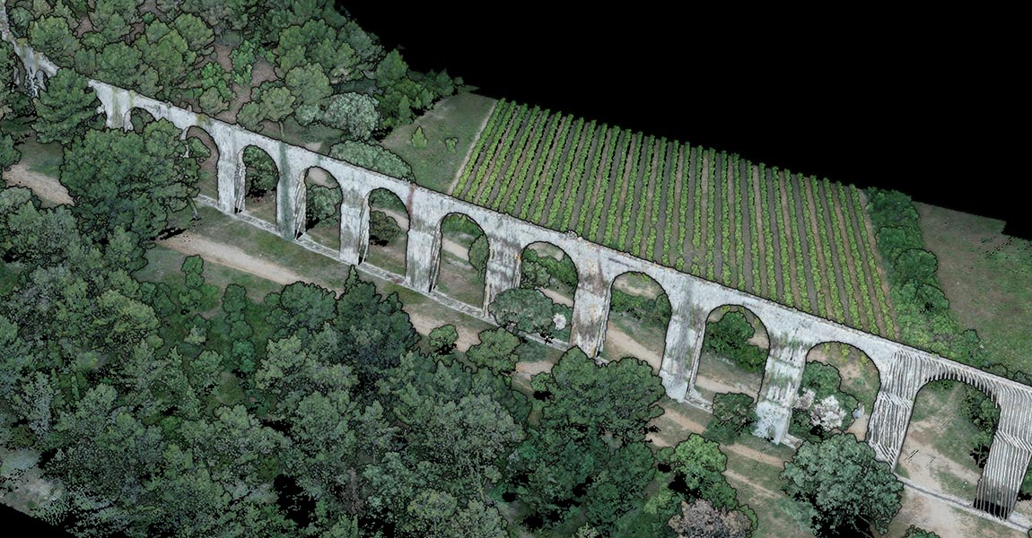
Discover the TUNDRA 2 equipped with the YellowScan Voyager LiDAR, used by Pyramid for a data acquisition operation at the Chabassot Viaduct site. To find out more, watch the video above. Discover our UAV LiDAR Solutions Find out more
Discover the Qube 640, a LiDAR scanner co-developed by YellowScan and Quantum Systems for optimal performance on Trinity Pro and Tactical drones. To find out more, watch the video above. Discover our UAV LiDAR Solutions Find out more
Learn step by step with Skyline Drones how to use a YellowScan LiDAR system with the DJI Matrice 300 RTK To find out more, watch the video above. Discover our UAV LiDAR Solutions Find out more
Discover how Skyline Drones uses the YellowScan Mapper+ and DJI M300 to inspect Romania’s largest powerline with LiDAR technology. To find out more, watch the video above. Discover our UAV LiDAR Solutions Find out more
Skyline Drones had the opportunity to work with the YellowScan Vx20, discover their review To find out more, watch the video above. Discover our UAV LiDAR Solutions Find out more
16 October 2024
Discover Skyline’s presentation about our Yellowscan Navigator and Yellowscan Vx20 & Ultra 3 LiDAR solutions To find out more, watch the video above. Discover our UAV LiDAR Solutions Find out more
Discover Most Robotics’ review of the YellowScan Navigator To find out more, watch the video above. Discover our UAV LiDAR Solutions Find out more
Discover how the Surveyor Ultra’s 360° field of view revolutionizes vertical mapping and mobile mapping To find out more, watch the video above. Discover our UAV LiDAR Solutions Find out more
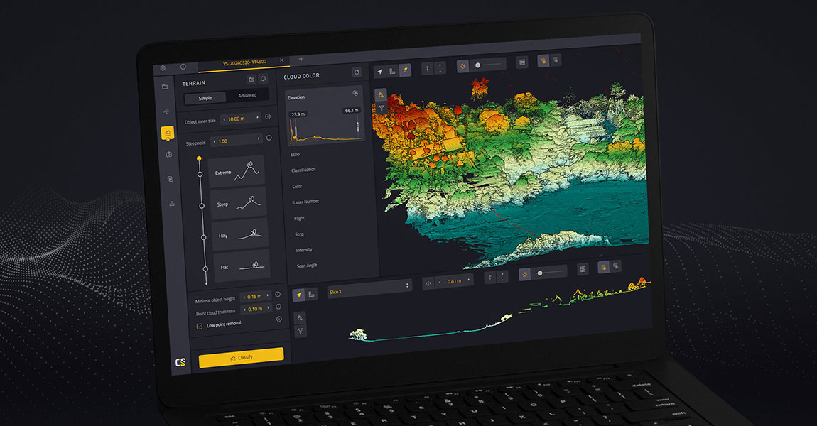
This article covers how LiDAR data is processed. We’ll cover the different steps required to turn raw point cloud data into useful information, and why these are important for end users. We’ll conclude with a brief overview of the functionality of CloudStation, which is YellowScan’s LiDAR data processing software. What is LiDAR data processing and […]
15 October 2024
Introducing 2D LiDAR This article covers 2D and 3D Lidar. We’ll compare both technologies and explain how they work, the different outputs of each, and their benefits, limitations, and popular use cases. What is 2D LiDAR and how does it work? This 2D sensing technology uses light to measure distances from its source to a […]
Montpellier, France – October 7, 2024 – YellowScan, a global leader in the aerial LiDAR solutions, has joined forces with DeltaQuad, a top Dutch drone manufacturer, to launch the Surveyor Ultra integrated into DeltaQuad’s drone technology. This powerful collaboration is set to significantly enhance productivity in UAV-based LiDAR mapping, offering unmatched efficiency for large-scale mapping projects. […]
7 October 2024
The Intergeo 2024 Conference took place in Stuttgart, Germany. YellowScan returned to INTERGEO in Stuttgart, Germany, held from September 24th to 26th 2024. Over the course of the event, we showcased our LiDAR products across two booths. At our main booth, we introduced the YellowScan Navigator, our new topo-bathymetric LiDAR system, making its first appearance at […]
World Premiere at the INTERGEO 2024 Show in Stuttgart. Drone manufacturer DELAIR and LiDAR specialist YellowScan unveil the DT46 LiDAR drone: the first fixed-wing drone enabling long-distance inspections and the production of highly precise digital twins. September 13th, Montpellier – Toulouse-based drone manufacturer DELAIR integrates the YellowScan Voyager LiDAR, a high-performance laser scanner coupled with a […]
17 September 2024
YellowScan had a strong presence at this year’s CUAV Expo in Las Vegas, showcasing its latest innovations and emphasizing its commitment to collaboration within the UAV industry. The event, known for gathering top players in unmanned aerial vehicle (UAV) technology, was the perfect place for us to highlight our ecosystem. Showcasing the YellowScan Navigator and […]
16 September 2024
Challenge Frontier Precision faced a critical challenge when their long-term client, the Alaska Department of Transportation (DOT), needed to rapidly and accurately map the area affected by the Mendenhall Glacier flood in Juneau, Alaska. This flood, triggered by unseasonably warm temperatures and heavy rain, caused significant runoff from the glacier, threatening the town and resulting […]

12 September 2024
Challenge Scandinavian Drone’s challenge was to showcase the YellowScan Navigator‘s performance in the murky, dark waters typical of Scandinavia. To address these concerns, Scandinavian Drone needed to show that the Navigator could accurately capture underwater features and sediment deposits, even in challenging conditions. The YellowScan Navigator mounted on the Hexadrone Tundra Using the Secchi disk […]
5 September 2024
August 23rd, 2024, Montpellier, France and Batesville, United States – YellowScan, a global leader in cutting-edge LiDAR technology, and WISPR, a pioneer in drone platforms and aerial intelligence, are excited to announce a new collaboration that will debut during the Commercial UAV Expo (CUAV) 2024 in Las Vegas. This partnership combines the expertise of both […]
This article covers how drones are used for surveying. The focus lies on lidar-based surveying using drones. We’ll explain how drones can capture survey-accuracy data, what type of data is captured, what data deliverables are created, and who uses it. What is drone-based surveying? Drone-based surveying (or mapping) uses unmanned aerial vehicles (UAVs) to collect […]
30 August 2024
YellowScan and Freefly Systems announce perfect integration of Aerial LiDAR and UAV Technologies, set to showcase at CUAV Expo in Las Vegas August 23rd, 2024, Montpellier, France and Woodinville, United States – YellowScan, a global leader in aerial LiDAR solutions, is proud to announce its successful integration with Freefly Systems, a renowned innovator in aerial […]
28 August 2024
August 27th, 2024, Montpellier – The year 2024 was marked by the release of the YellowScan Navigator LiDAR system. This innovation represents a turning point in the industry and opens up new possibilities in the field of bathymetric mapping. Behind the innovation, research and development is often a long process that requires human and financial resources. At […]
27 August 2024
August 23rd, 2024, Montpellier and Espoo – YellowScan a leading provider of advanced Lidar technology, and Nokia, a B2B technology innovation leader, are pleased to announce a strategic partnership aimed at revolutionizing industrial operations through the integration of the YellowScan Surveyor Ultra Lidar scanner into the Nokia Drone Networks solution. This collaboration focuses on automation […]
23 August 2024
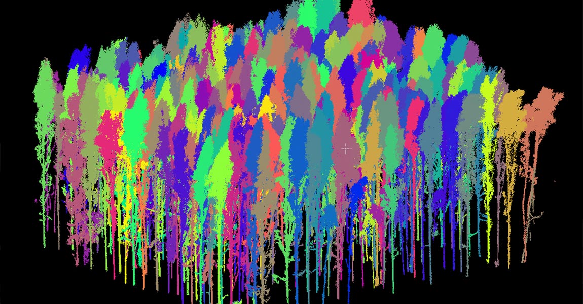
Challenge Our customer PXL BIO-Research offers practice-oriented solutions in urban greenery management based on innovative research. In this context, they noticed an increasing demand from municipalities, urban planners and urban foresters for tools and expertise related to the digital inventory of urban green. Both updating tree inventories and assessing the condition of trees are time-consuming […]
14 August 2024
What is mobile LiDAR scanning and how does it work? It is a data acquisition method that uses a continuously moving platform to collect survey-grade 3D point data quickly and accurately. It is more than just a laser scanner mounted on a moving platform: a single mobile scanning system integrates cameras, sensors, positioning and orientation […]
8 August 2024
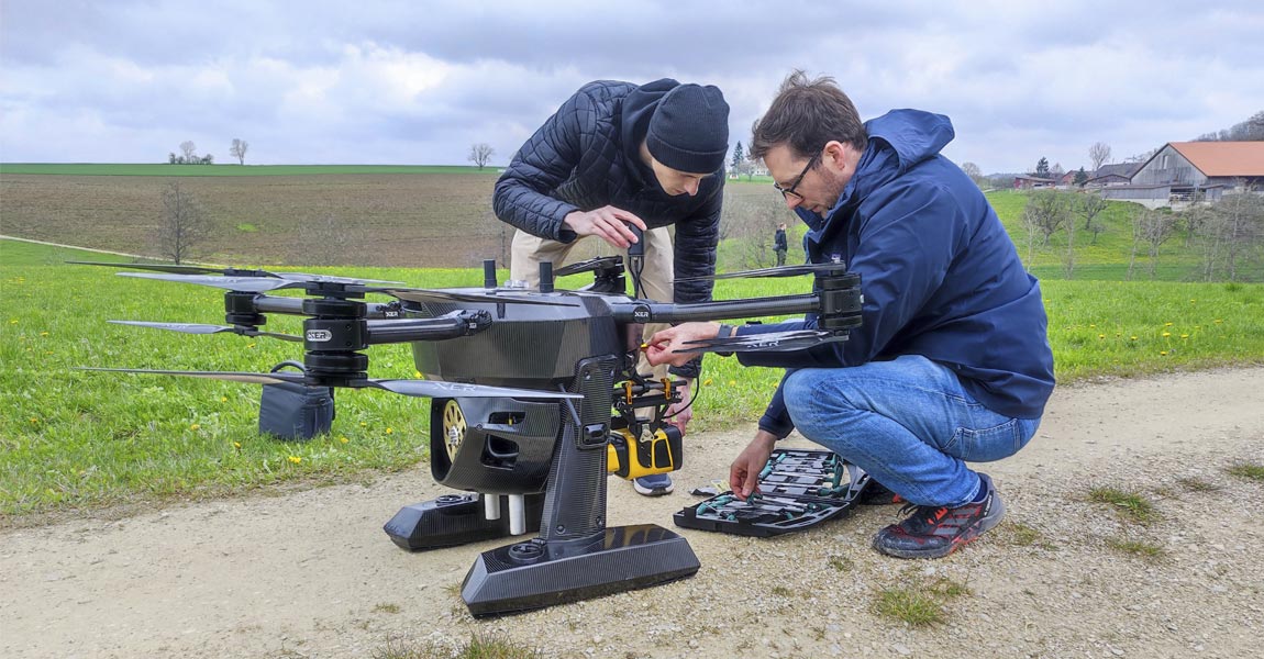
Xer Technologies and YellowScan Announce Long-Range Bathymetric Water Survey and Underwater Inspection Solution Montpellier, France and Dietikon, Switzerland, July 30, 2024 Xer Technologies, a trailblazer in drone technology, and YellowScan, a leader in UAV LiDAR solutions, are excited to announce the successful integration of the YellowScan Navigator bathymetric system into Xer Technologies’ drones, enabling unprecedented […]
1 August 2024
This article compares two popular technologies for creating 3D models and maps: photogrammetry and LiDAR. The focus lies on key differences between both: how they work, the different outputs created for each, and popular use cases. The article finishes with a discussion of why investing in LiDAR can be a better choice, despite higher costs. […]
2 July 2024
This article explains what LiDAR point clouds are and how they are used. You will learn how they are collected, what data is stored inside a point cloud, and how to visualize them. Finally, you’ll learn how point cloud data is managed and processed so that it can be used for various applications. Defining a […]
24 May 2024
Challenge The University of Vermont (UVM) in the USA became involved in this project through its connections with the Vermont Geological Survey (VGS) and the Vermont Agency of Transportation (VTrans). UVM is one of the few organizations in the state with access to UAS LiDAR technology, making it a priority contact for capturing accurate elevation […]
23 May 2024
LiDAR scanners are used for capturing 3D point clouds. But how do they work? This and more are explained in the article below, which covers the operating principle of different LiDAR scanners and explains how distance measurements are transformed and combined into 3D point clouds. These provide the basis for many 3D mapping products used […]
30 April 2024
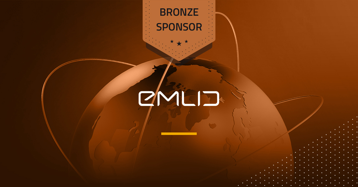
YellowScan announces EMLID as a Bronze Sponsor of the YellowScan LiDAR Convention 2024. Montpellier and Budapest – March 21st, 2023 – YellowScan, a global leader and designer of next-generation manned and unmanned LiDAR solutions, is pleased to announce EMLID as a Bronze Sponsor of its newly renamed LiDAR for Drone event, the YellowScan LiDAR Convention […]
22 March 2024
Introduction to Flight Planners A LiDAR drone is an unmanned aerial vehicle (UAV) equipped with Light Detection and Ranging (LiDAR) sensors. A LiDAR is an active sensor that uses inertial measurement to correlate where it is on the earth’s surface, resulting in a direct measurement of the earth. These measurements are visualized in a 3D […]
8 March 2024
YellowScan announces SBG Systems as a Silver Sponsor of the YellowScan LiDAR Convention 2024. Montpellier and Carrières-sur-Seine, France – February 9th, 2024 – YellowScan, a global leader and designer of next-generation manned and unmanned LiDAR solutions, is pleased to announce SBG Systems as a Silver Sponsor of its newly renamed LiDAR for Drone event, the […]

28 February 2024
Challenge Carbonix, a leading manufacturer of commercial UAVs in Australia, became involved in a significant project when approached by an Australian power network seeking solutions for scanning their transmission and distribution lines in challenging, undulating terrain. They reached out to Carbonix to see if they had a system and sensor combination that could effectively meet […]
14 February 2024
YellowScan announces Applanix as a Gold Sponsor of the YellowScan LiDAR Convention 2024. Montpellier, France and Richmond Hill, Canada – February 9th, 2024 – YellowScan is pleased to announce Applanix as a Gold Sponsor of its newly renamed LiDAR for Drone event, the YellowScan LiDAR Convention, returning in April 2024. This year’s conference will feature over […]

13 February 2024
How does laser scanning work underwater? How can a laser penetrate water? What are the main benefits and challenges when using this technique? What happens when a laser pulse hits the water? This and more is explained in the following article about bathymetric LiDAR. Measuring underwater depths People have studied the underwater depth of river, […]
5 February 2024
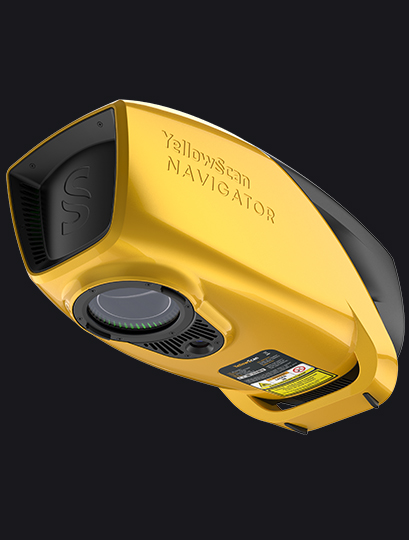
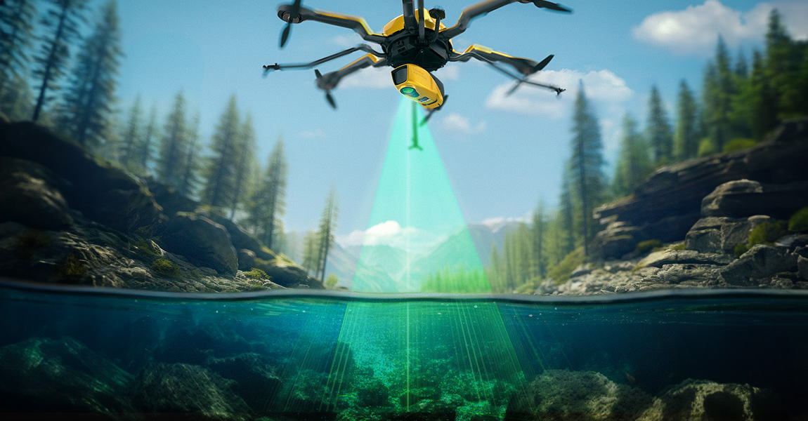
Introducing the YellowScan Navigator: a groundbreaking bathymetric LiDAR System dedicated to coastal and river mapping from drones Montpellier, France, January 4th, 2024 – YellowScan, a global leader and designer of the next generation of manned and unmanned LiDAR solutions, is thrilled to announce the release of its new bathymetric system, the YellowScan Navigator, at the […]
9 January 2024
Challenge The project came about because an engineering company sought high quality topographical data to reassess how they were going to resume mine operations. This involved tasks such as creating new roads, avoiding collapse-prone areas, and creating protection meshes, etc. The culmination of these efforts resulted in the development of a master plan to reactivate […]
14 December 2023
Initiated in October, the Next-2Digits project brings together 11 companies spanning across Europe. In collaboration with GrapheneEU, this consortium is committed to advancing expertise in the graphene domain and disseminating knowledge to diverse stakeholders. The main goal of this project is to pioneer the development of the next generation of sensors and imagers, leveraging the […]
4 December 2023
Challenge European Hamsters are a protected species living in agricultural areas, often alongside field mice, which are considered pests. Lack of awareness about hamster presence leads to unintentional harm by farmers, endangering the European Hamster population. CRIFORA OG (a partnership between UMGEODAT Gbr and Grüne Umwelt) recognized the need to improve precision in detecting hamster […]
18 November 2023
The Intergeo 2023 Conference took place in Berlin, Germany. We were thrilled to return for the 6th consecutive year as exhibitors! All three days were busy, filled with a continuous stream of meetings, from potential customers, to partners, to press interviews. We took advantage of our distributors and partners’ presence at the event to conduct […]
19 October 2023
Our primary goal is to provide the best quality products and support to our customers. In addition to the technical aspects of our work, we place customers at the center of our concerns. Why should you choose our brand? With YellowScan you’ll integrate an entire ecosystem with the same ease-of-use philosophy from the field, with […]
10 October 2023
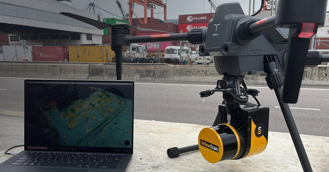
In recent years, advancements in unmanned aerial vehicle (UAV) technology have enabled the collection of accurate and rapid data for various applications. One such application is ground topography determination, crucial for a range of fields such as agriculture, urban planning, and environmental monitoring. This case study presents the utilization of the YellowScan Vx20-300 sensor on […]
25 September 2023
In the realm of environmental monitoring and analysis, the accurate assessment of vegetation plays a crucial role in understanding ecosystems. Drones equipped with advanced imaging technologies have revolutionized this process by providing efficient and precise data collection methods. This case study highlights the use of the Mapper and Mapper+ LiDAR systems, along with their specific […]
22 September 2023
The YellowScan LiDAR Convention will be held on April 18th and 19th, 2024 at the Domaine des Moures, near Montpellier, France. It is a great opportunity, for those interested in the LiDAR industry, to share experiences with experts in the field, receive feedback from peers, and be inspired by LiDAR users and the YellowScan team. […]

What is a LiDAR for drones? In the realm of modern technology, LiDAR (Light Detection and Ranging) has emerged as a ground breaking innovation, particularly when combined with drones. This fusion empowers industries to redefine data acquisition, mapping, and analysis. Let’s take a closer look at LiDAR for drones and see how this dynamic pairing […]
1 September 2023
What is this laser technology making mapping possible through vegetation, in low-contrast or shadowy situations? LiDAR: Light Detection and Ranging Light Detection And Ranging (LiDAR) is a laser-based remote sensing technology. The idea behind LiDAR is quite simple: point a small laser at a surface and measure the time it takes the laser to return […]
25 August 2023
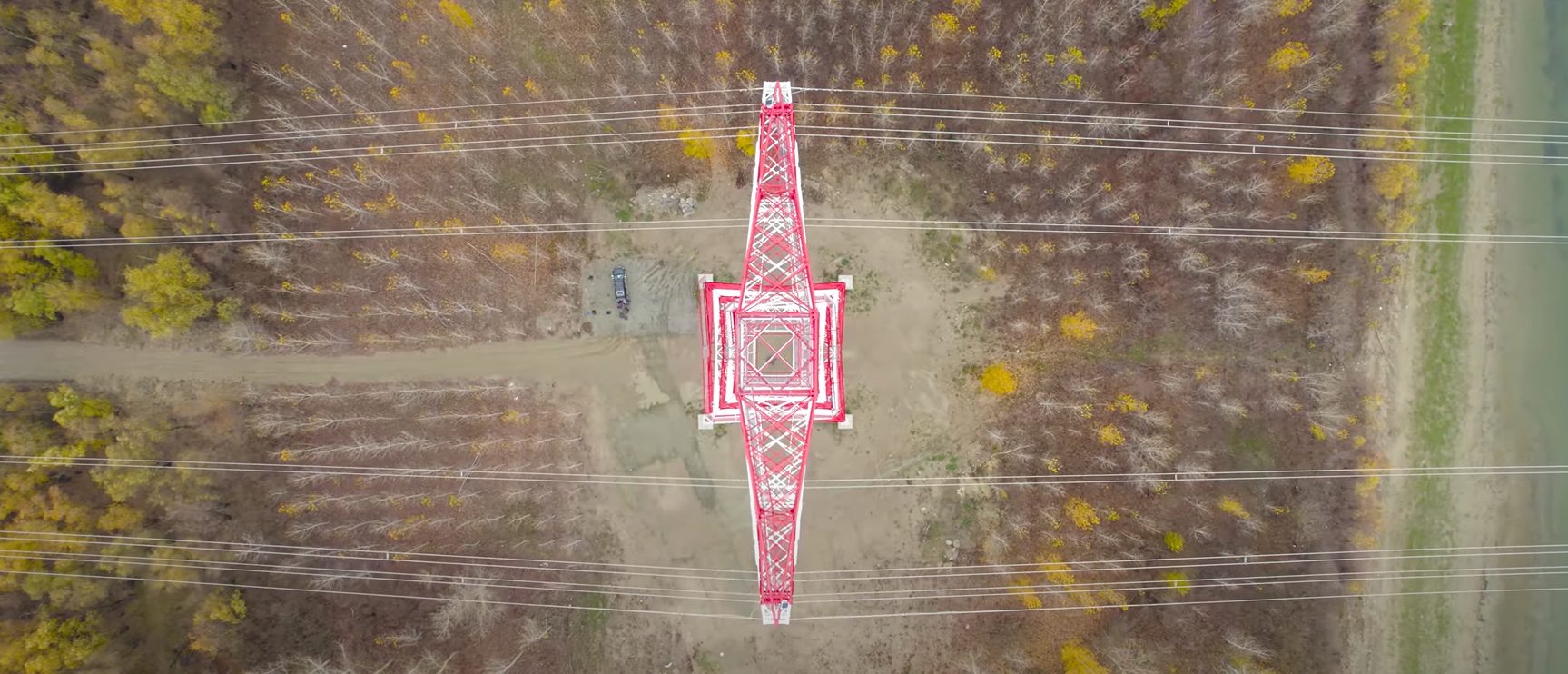
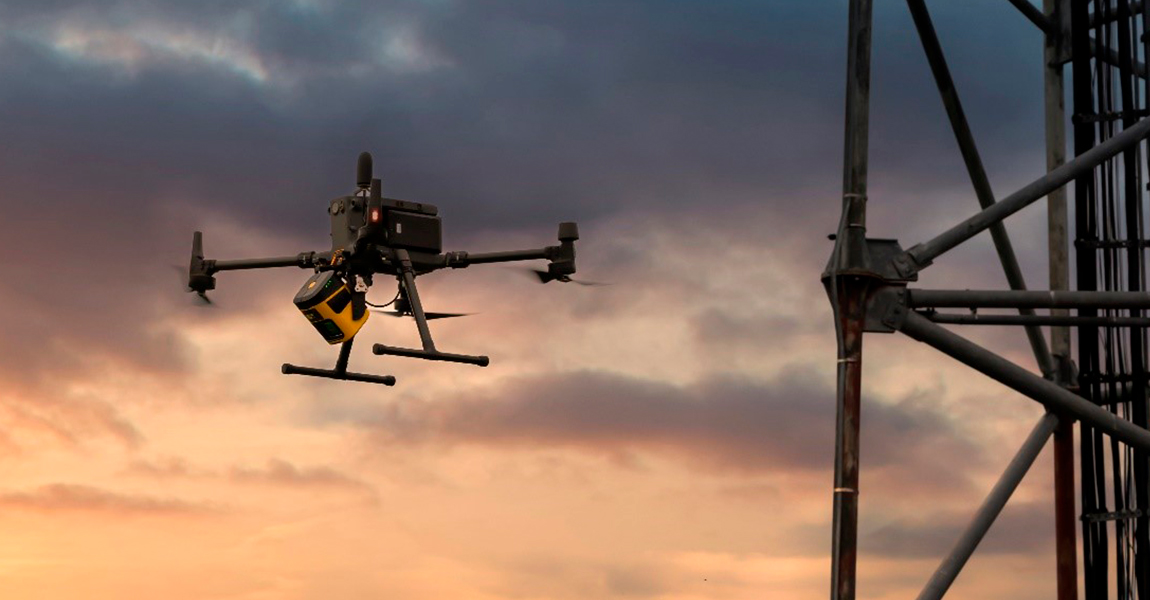
Challenge Our customer La Orizont carried out LiDAR inspections of a telecommunications tower for one of their partners. The purpose of this inspection was to create a digital twin that offers the possibility to perform several types of analysis: Line of sight analysis: Allows for the detection of objects that obstruct signal transmission. It also […]
21 August 2023
Charlotte, North Carolina, USA and Montpellier, France – July 19th, 2023 – YellowScan, a global leader in LiDAR solutions, is pleased to announce its partnership with Duncan-Parnell, a prominent provider of geospatial solutions. The collaboration aims to strengthen YellowScan’s distribution network in the Southeastern United States and surrounding areas and provide customers with enhanced access to […]

21 July 2023
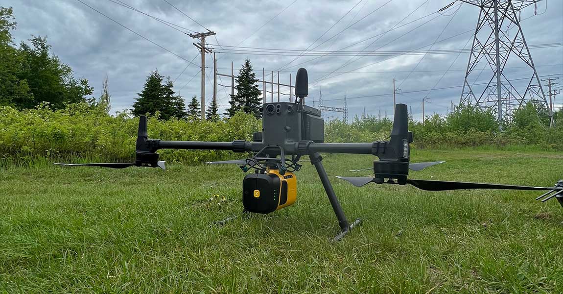
Our client, CIMA+, a renowned multidisciplinary company based in Canada, specializes in engineering, project management, and consulting services across various sectors. They were commissioned to conduct surveys of electrical powerlines. Challenge: CIMA+’s surveying department was internally commissioned by their engineers to perform surveys of the electrical wires, following unsuccessful attempts by an external provider. The […]
12 July 2023
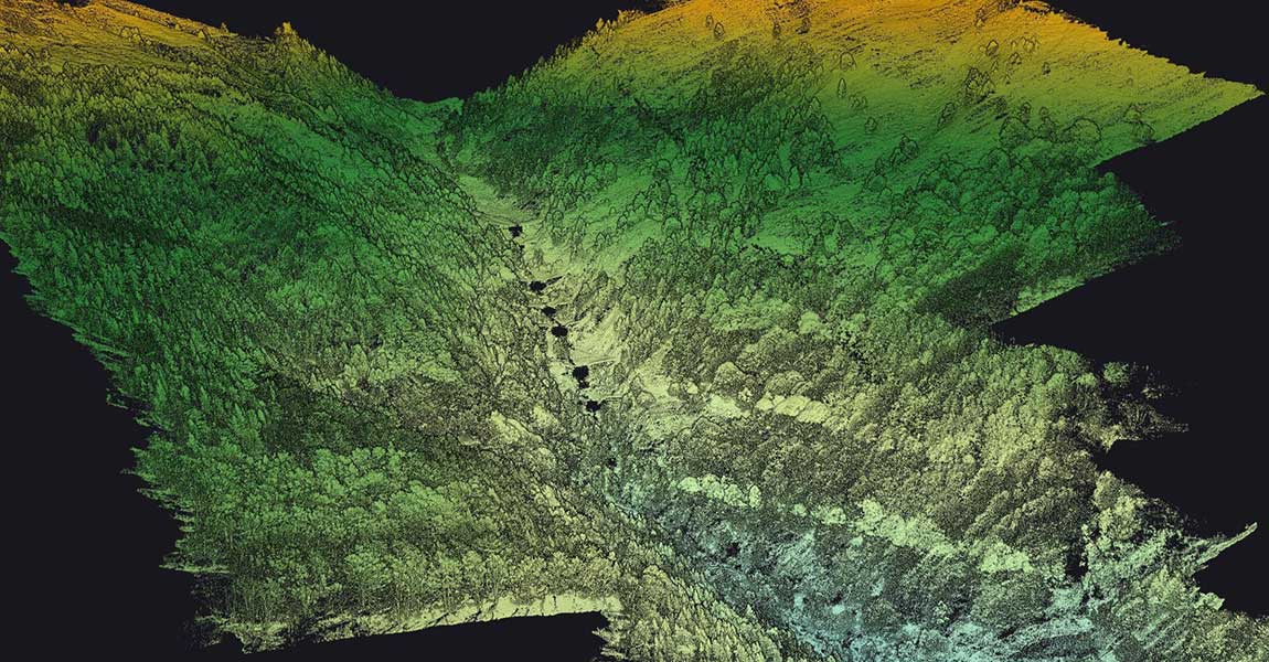
Challenge This mission was started in response to a request from the Departmental Directorate of Territories, which lacked LiDAR equipment and therefore outsourced the entire data capture process to drone companies. The objective was to conduct a comprehensive modeling of four avalanche corridors in the Pyrenees, covering a total area of 430 hectares (1 060 […]
11 July 2023
There is no excerpt because this is a protected post.
30 June 2023
Our YellowScan LiDAR solution is now integrated into the latest DeltaQuad Evo UAV, making it the world’s first fixed-wing VTOL UAV with our combined YellowScan LiDAR mapping system & RGB camera module. Here’s what you need to know about this partnership: Groundbreaking collaboration pushing the boundaries of georeferenced colorized LiDAR data and terrain coverage. DeltaQuad […]
15 June 2023
Nokia, our new partner, recently announced an exciting partnership with Citymesh, a prominent telecom operator based in Belgium. The collaboration entails the deployment of 70 state-of-the-art Drone-in-a-Box (DiaB) units from Nokia’s Drone Networks platform. This article was written by Jessica Reed and published by Avionics International. Read the full press release Download PDF File
Challenge Following a successful research and development collaboration with a government agency, our customer GeoAerospace obtained a contract to perform airborne LiDAR capture in various forestry sites along the secluded west coast of Ireland. Their primary objective was to acquire high-quality airborne LiDAR data, as it is crucial for mapping remote mountainous regions as part […]
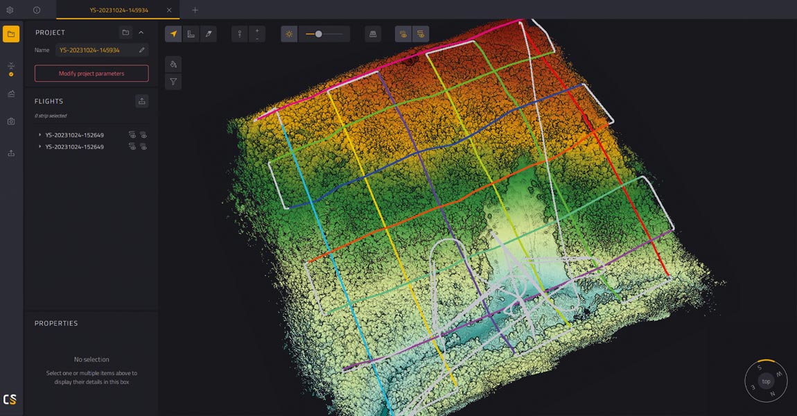
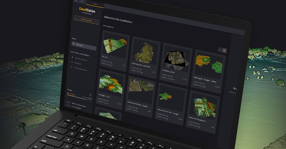
YellowScan streamlines trajectory refinement with latest CloudStation update Montpellier, France – June 1st, 2023 – YellowScan, a renowned global leader in designing cutting-edge LIDAR solutions, is excited to announce the seamless integration of POSPac into its proprietary software, YellowScan CloudStation. This update brings a major enhancement to the YellowScan CloudStation environment by integrating Applanix POSPac […]
1 June 2023
Yellowscan LiDAR has been tested and certified as compatible with the Xer X8 UAV platform. Montpellier, France and Zürich, Switzerland, 23 May 2023 – Xer Technologies AG, a Swiss leading manufacturer of long-endurance hybrid-electric drones and YellowScan, a global leader and designer of manned and unmanned LiDAR solutions are pleased to announce that the Yellowscan LiDAR has been tested […]
24 May 2023
Back to basics A photosensitive sensor is composed of a multitude of pixels, a surface area that is mostly square in shape. These pixels are a component of photodiodes that convert light into an electrical signal. There is a common belief that the more pixels there are, the better the picture, but this is not […]

15 May 2023
Page 1 of 2


