CloudStation LiDAR processing software.
Turn physical projects into digital realities.
Want to discover more?
Contact our team of experts or download our software datasheet below:
The CloudStation is an evolutive and user-friendly LiDAR software, developed by YellowScan, to generate and visualize pointclouds.
Our software provides you with auto-detection of strips, in-depth configuration and LAS files exports to interface with all your tools.
Change the way you work with LiDAR data
Our CloudStation software is available as a floating license, allowing users to install it on as many computers as needed. Three CloudStation software bundles are available:
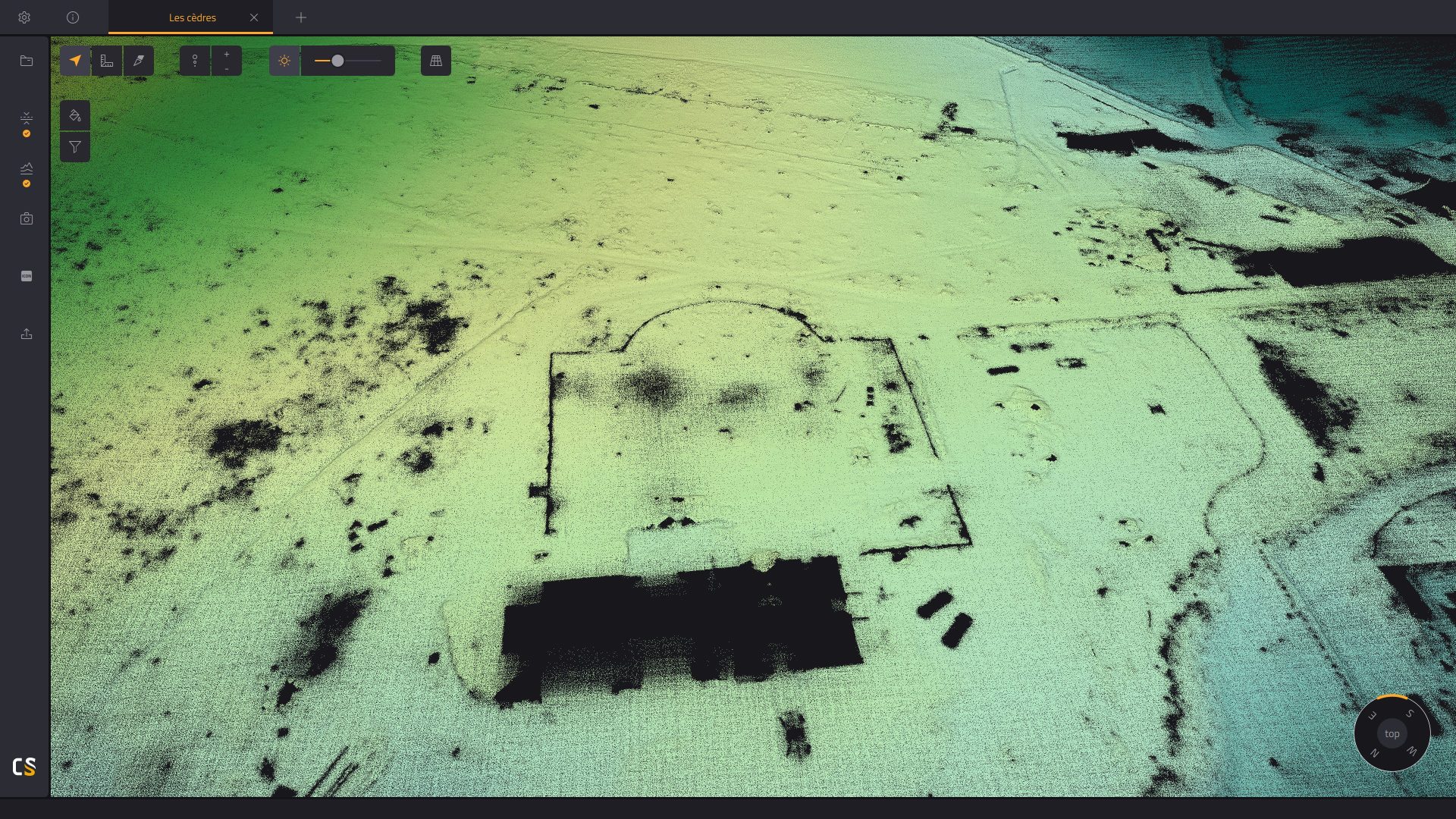
Point cloud classification
Export 3D classified pointclouds
Smoothing
Enhance the precision of your point clouds by reducing ranging noise.

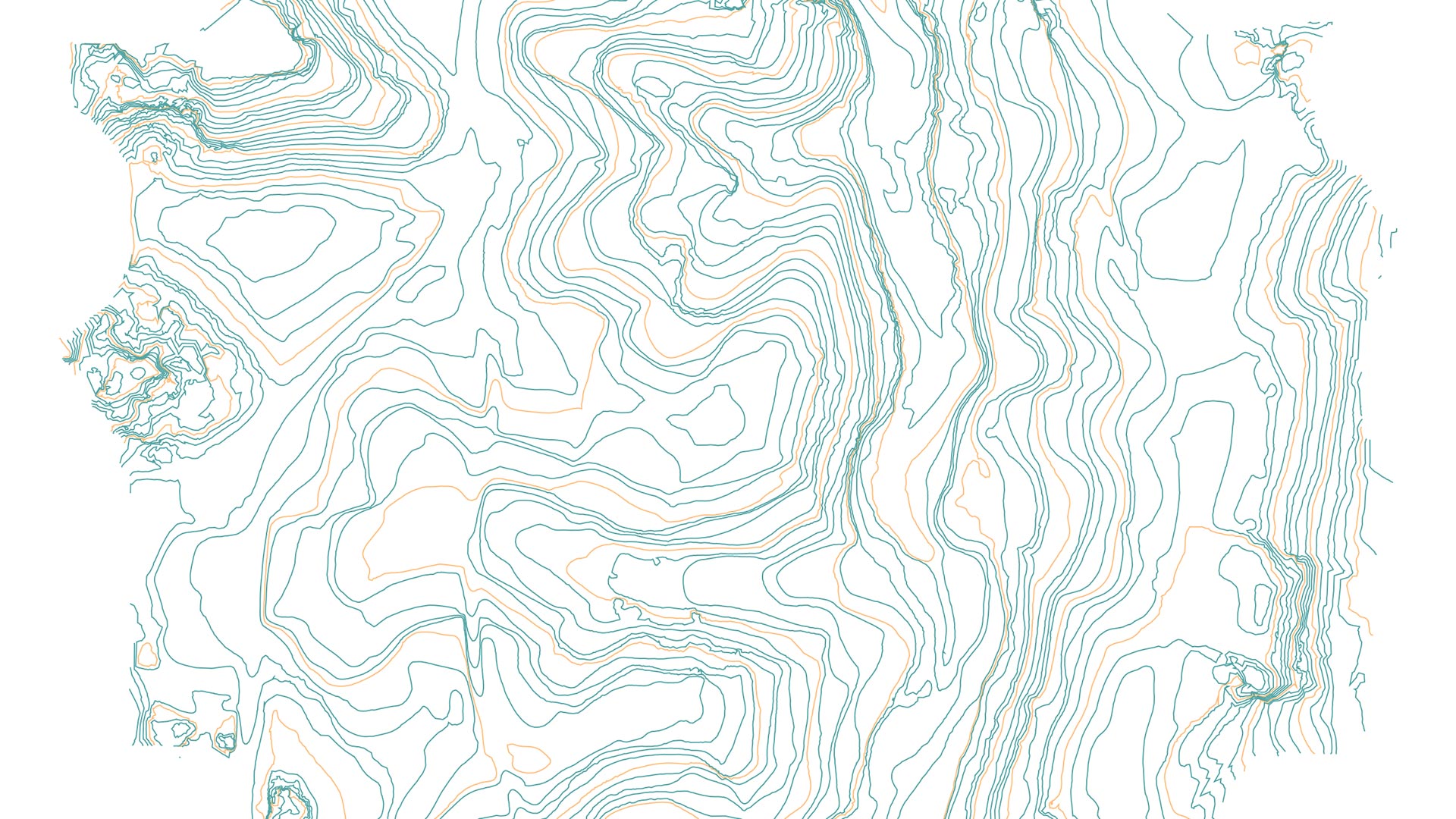
Contour Lines generation
Create and export customizable contour lines from classified point clouds.
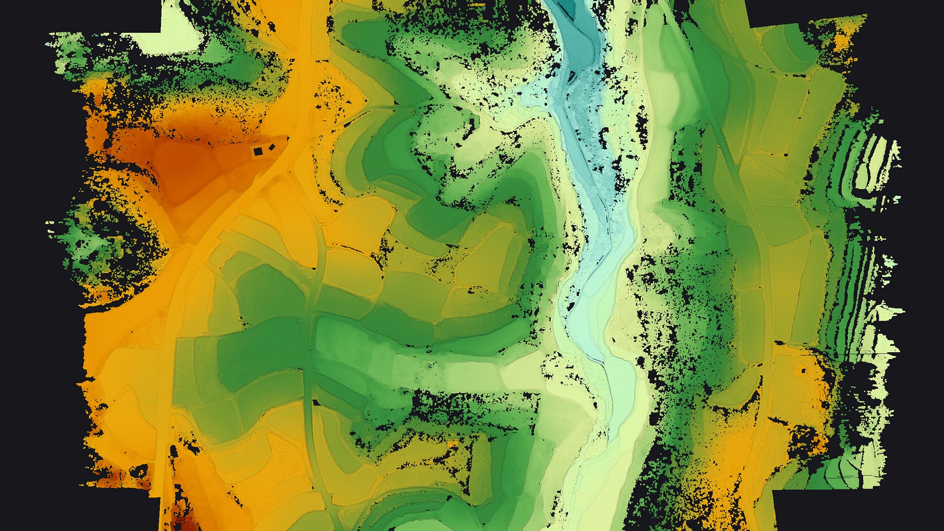
Strip adjustment
Modify strips or flight lines and enhance the quality of your pointcloud.
Point cloud colorization
Export colorized pointclouds from simultaneous LiDAR + camera acquisition.
Key features:
- Combine the data generated from your flight with photos taken simultaneously to generate a colorized pointcloud
- Colorize and visualize your strips
- Automatic LiDAR–camera calibration and refinement
- Two colorization methods available
- Designed for our camera hardware
- Colorization from external orthophotos available
YELLOWSCAN CLOUDSTATION
Next-level LiDAR survey quality
Designed to improve data and set high standards regarding the quality of your surveying projects.
![]()
10 years’ experience in LiDAR technology
Our R&D team strives to innovate, develop new functionalities and improve the CloudStation on a day-to-day basis; so much so that a new release of the CloudStation comes out every 3 weeks.

Get expert advice and guidance
YellowScan’s knowledgeable team is here to support you, be it for a quick consult or training.
The CloudStation comes in an annual licensing scheme with a 1-year maintenance, including support and software updates.

Explore our product datasets
Discover sample data captured with our LiDAR systems, select a specific sensor and download the associated dataset.

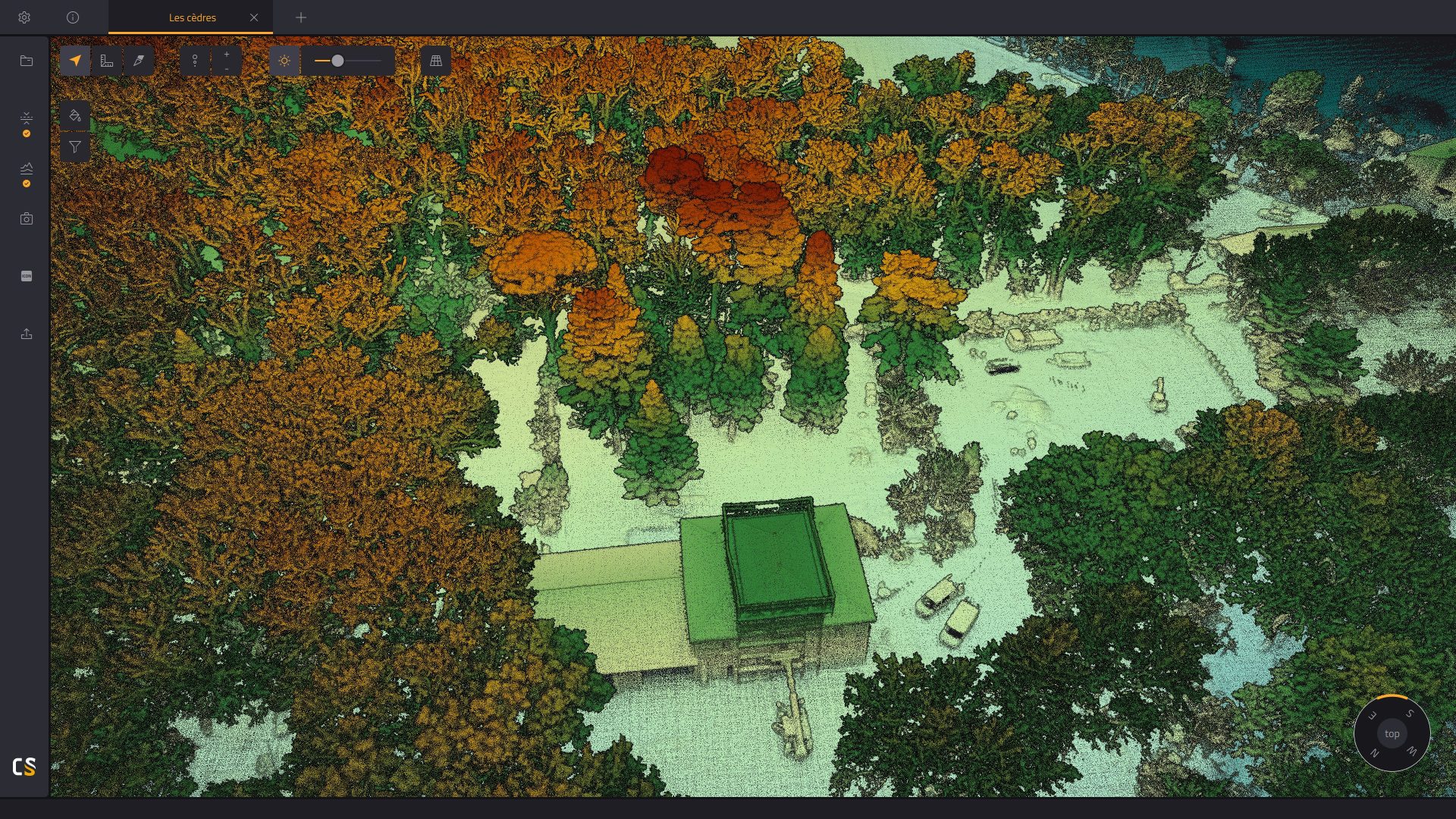
Point cloud visualization, inspection, and in-depth examination
The CloudStation’s powerful 3D engine allows you to effortlessly display billions of points, measure distances, and get information about your points in one click.
*Our CloudStation software is designed for desktop use and is not cloud-based.

Increased productivity. Maximized budget.
Extract, process, display and export LiDAR data right after a flight.
Effortlessly handle multiflight acquisitions in a single project.
Easily refine your trajectory thanks to the POSPac integration
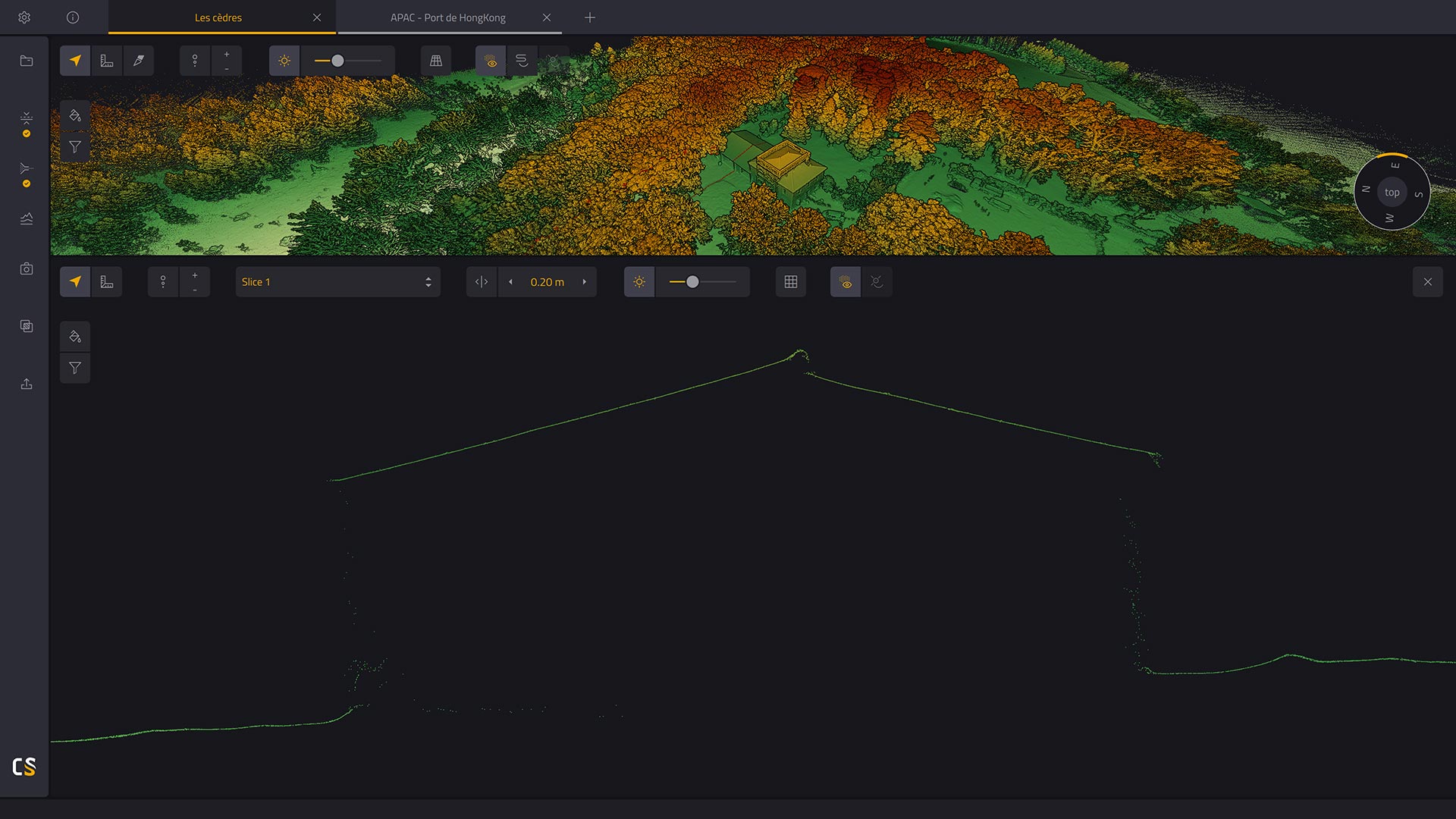
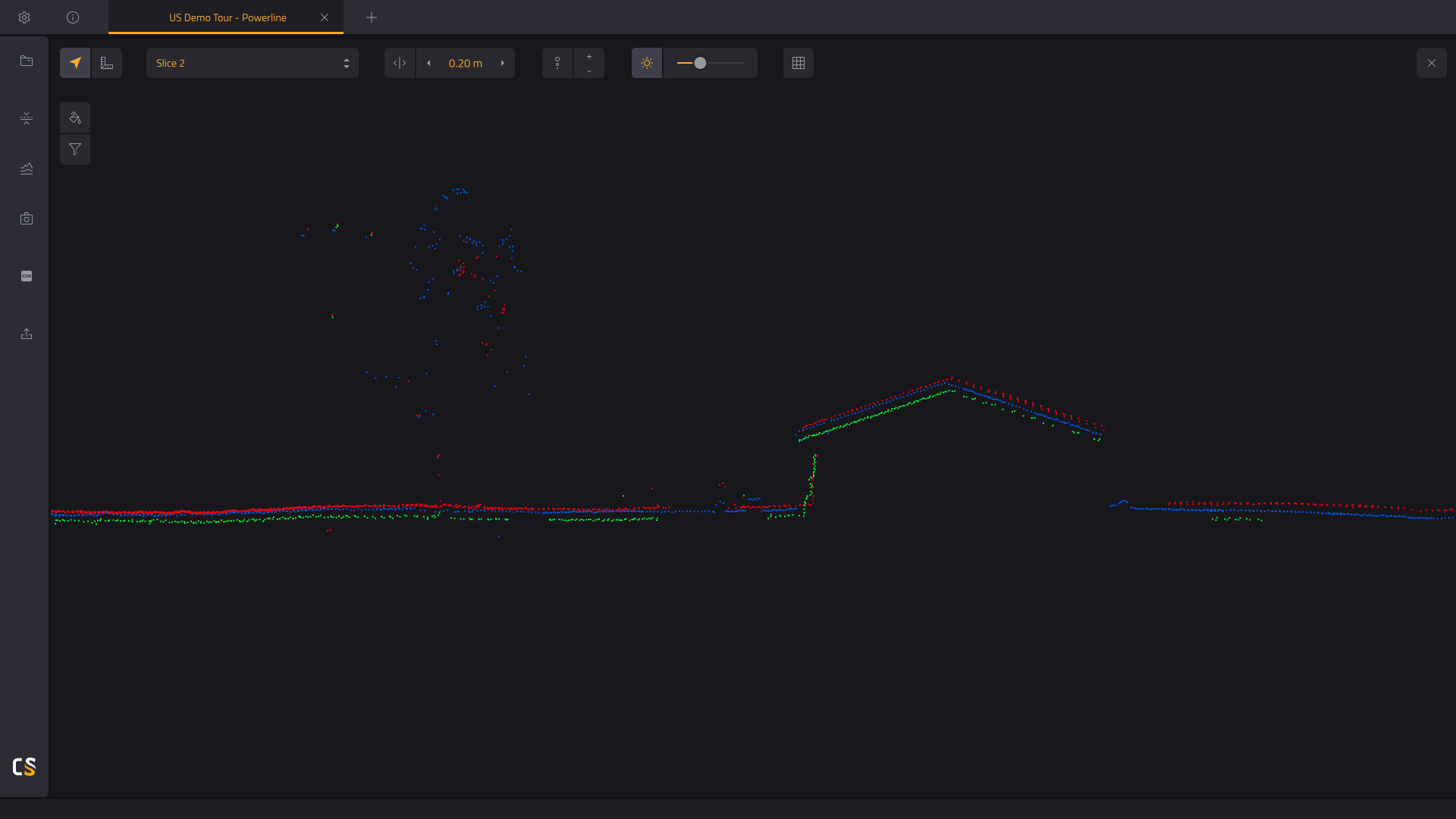
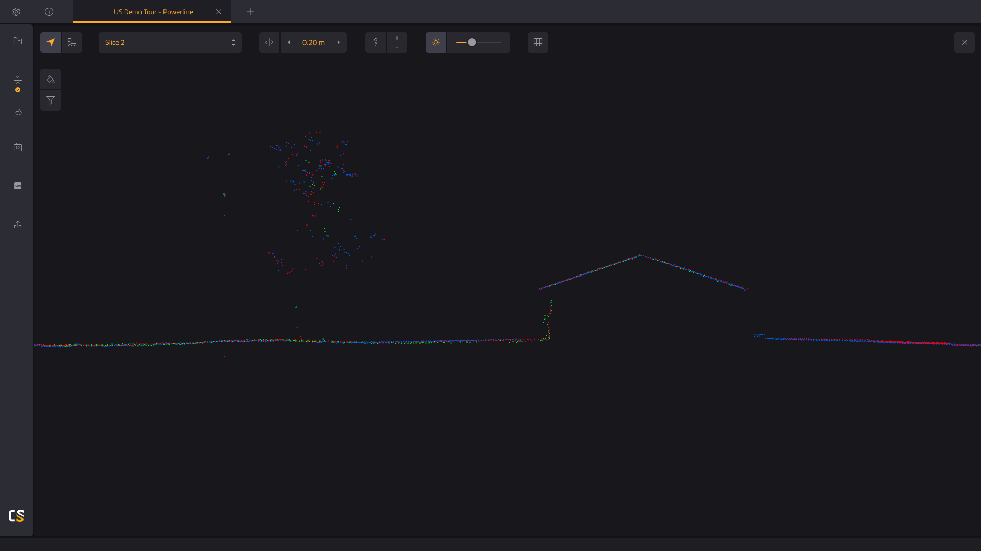
Vertical slicing of your generated point cloud
Get a better understanding of your generated point cloud.
- Measure denivelation.
- Assess the quality of the Ground classification, by checking the base of the vertical elements.
- Check the mismatch between flightlines, by measuring the strip-to-strip distance. Before, or after strip adjustment.
