Supporting Coastal Erosion Program in Sweden with Bathymetric LiDAR
Challenge
Located on the southernmost coast of Sweden, Ystad is a popular region known for its shallow sandy beaches and thriving tourism. However, its exposure to strong winds and waves across the Baltic Sea makes it particularly vulnerable to coastal erosion.
To understand these natural dynamics, the Ystad Municipality has implemented a long-term coastal monitoring program, collecting data on both shoreline movement and underwater topography. Traditionally, bathymetric data was collected using boat-mounted sensors, but the shallow, turbulent nearshore waters made it difficult to measure bottom topography with sufficient resolution.
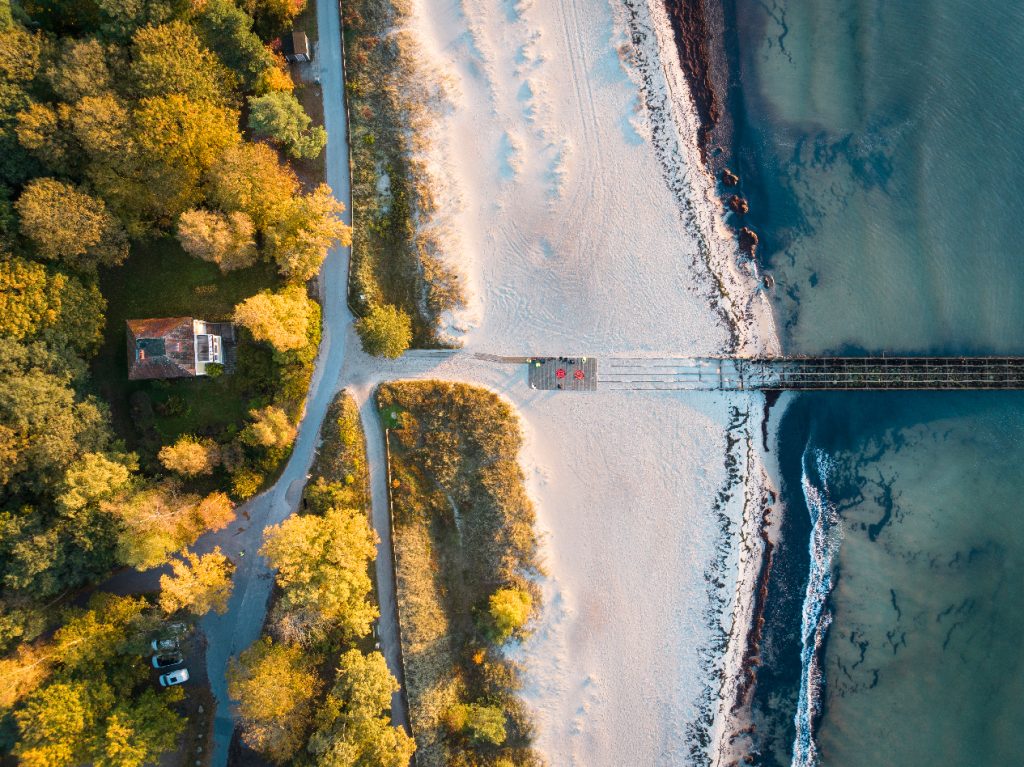
Aerial picture of the beach
Solution
To address these limitations, VisionAir Production suggested using the YellowScan Navigator, a UAV-mounted green LiDAR system, to perform aerial bathymetric scanning, a first in Sweden. The municipality welcomed the approach, which allowed for efficient data collection with minimal environmental impact.
By combining the bathymetric data from the Navigator with topographic LiDAR collected over land (DJI Zenmuse L2), VisionAir Production created a seamless dataset extending from 6 meters below the water surface to 100 meters inland, ideal for erosion modeling, sediment tracking, and long-term coastal management.
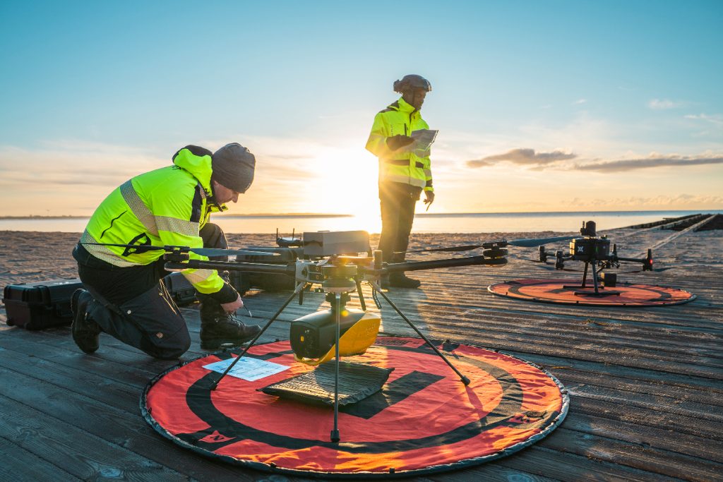
The team at VisionAir Production getting the equipment ready for the acquisition
Mission Parameters
Survey size
Total area of survey for both land and water was approximately 550 Ha (5,5 km2).
Total distance of coastline was approximately 8700 m and total area of bathymetric mapping was approximately 299 Ha (103 Ha Ystad Sandskog location + 196 Ha Löderup strandbad location), from waters edge out to a depth of 6 meters.
Duration
The total area was divided up into two zones.
- Area number 1, Ystad sandskog, was scanned between November 12-15th
- Area number 2, Löderups strandbad, was scanned between November 8-11th, with additional collection filled on November 21st.
Number of flights
49 flights total
Flight altitude & speed
YellowScan Navigator: 70 m MSL at 5m/s
Equipment used
YellowScan Navigator paired with Hexadrone Tundra 2 (drone).
Data points were then matched with LiDAR data from DJI Zenmuse L2 used for land mapping and combined into seamless water-land LiDAR image.
For data processing
- DJI Terra
- YellowScan CloudStation
- TerraSolid TerraScan UAV
- CloudCompare
- Agisoft Metashape Professional
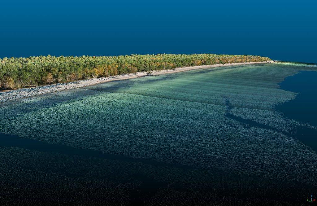
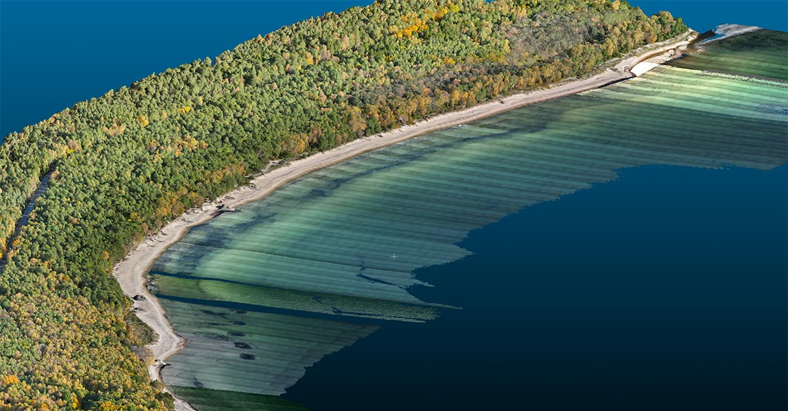
Pointcloud of the beach
Results
Point density: 44 pts/m²
The YellowScan Navigator enabled VisionAir Production to deliver high-quality, reproducible bathymetric data, even in shallow and turbulent nearshore zones. The survey allowed for the smooth integration of underwater and land-based LiDAR, resulting in clean DTMs and contour lines across the entire study area.
In total, the mapped area more than doubled compared to previous years, expanding from around 205 hectares to 562 hectares. The data revealed clear erosion hotspots, identified sediment transport down to 2 meters depth, and showed a westward shift in sediment movement, contrary to trends observed in earlier surveys.
The project proved to be cost-effective, environmentally low-impact, and easily replicable. Fast deployment and minimal disruption to nature or people were key advantages, and the reliability of the method convinced the Ystad Municipality to award VisionAir Production a three-year contract extension.
The YellowScan Navigator stood out for its precision in shallow waters, efficient land–water data fusion, and the excellent technical support that ensured smooth processing and consistent results.
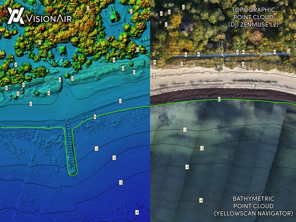
Bathymetric pointcloud obtained with the YellowScan Navigator
The Navigator is a one of a kind when it comes to seamless, high accuracy, LiDAR scanning in shallow waters. We can now present data to our clients that just was not possible before the Navigator was developed. Being able to seamlessly stitch underwater bathymetric data with land topography data is nothing short of magical!

The shallow near-shore waters are normally difficult to get bathymetric data from but with the YellowScan Navigator LiDAR solutions mounted to our drone it has changed the game completely. Now we can offer accurate and cost-effective solutions to our clients, and provide them with the data they need fast.

