Colorization, the new software module by YellowScan

Latest add-on for the YellowScan CloudStation makes it easier than ever to colorize and visualize your data in a few clicks
Montpellier, France – June 24rd, 2021 – YellowScan, a global leader and designer of UAV LIDAR solutions, announces the immediate availability of its new software add-on module: Colorization. This third software module enhances the capability of CloudStation, YellowScan’s powerful data processing tool that provides users the ability to create and manipulate point-cloud data from their LiDAR surveys.
Understanding the importance of merging image-derived RGB colors with LiDAR, YellowScan developed this new module following the same path as the other add-on modules, allowing for easy-of-use and enabling users to get results in only a few clicks. Made for the latest YellowScan Mapper camera hardware it is also compatible for owners of single camera package (Sony A6000 or A7R). The advantage of this new module being that the colorization process occurs directly inside CloudStation, saving time to generate the final output and making it easier to manipulate your data.
How does it work?
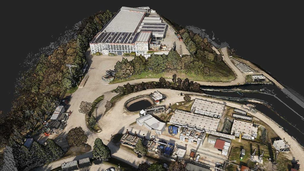
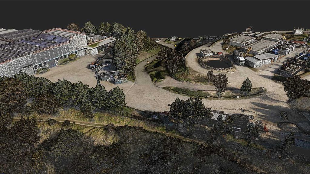
The Colorization module allows you to combine the point-cloud data you have generated from a flight and combine it with multiple photos taken simultaneously, thus generating a colorized point-cloud. The Colorization process automatically refines the camera alignment with the LiDAR on a per-flight basis ensuring the quality of the final colorized product.
“We heard from numerous customers that being able to manage the colorization process from within CloudStation would be a big advantage, we feel this new module satisfies this request. We also felt it was important to build this with the active participation of our user community, so several client beta-testers worked with us to produce the final version to make sure we got it right”, stated Morgane Selve, Product Manager, YellowScan.
CloudStation and its other two add-on modules, Strip Adjustment and Terrain, are already available with the acquisition of a YellowScan LiDAR solution and extend the effectiveness of your YellowScan solution.
About YellowScan
At YellowScan we design, develop, and build our UAV LiDAR solutions to exceed the expectations of professionals that require performance, robustness, and accuracy. Our complete hardware and software solutions are easy to use data collection tools coming with an unparalleled level of training and support from our experts.
Founded in 2012, YellowScan has customers around the world, and its products are used in surveying, forestry, environmental research, archaeology, industrial inspection, civil engineering, and mining sectors. Based in the South of France, we have sales and support offices around the globe.
For more information, please visit www.yellowscan.com
Contact
Morgane Selve, Marketing Manager at YellowScan
For more information contact us at press@yellowscan-lidar.com