LiDAR for Power Utility Vegetation Management

Challenge
Carbonix, a leading manufacturer of commercial UAVs in Australia, became involved in a significant project when approached by an Australian power network seeking solutions for scanning their transmission and distribution lines in challenging, undulating terrain. They reached out to Carbonix to see if they had a system and sensor combination that could effectively meet their brief.
The primary issue at hand was the encroachment of vegetation alongside the utility poles and wires, requiring precise analytics and mapping.
The mission objective was clear: to address the encroaching vegetation and conduct detailed analytics on the poles and wires.
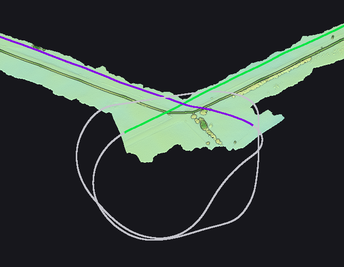
Flight path (trajectory) taken to ensure adequate coverage of the distribution lines during a bend. Capture should be straight and level with minimal banking.
Solution
As a business, Carbonix needed a lightweight sensor compatible with their RPAS (Remotely Piloted Aircraft Systems), capable of accurately delineating and capturing the powerlines while ensuring precise strip alignment for thorough coverage, including a swath that covers the vegetation in proximity to the line.
The YellowScan Mapper+ OEM was the perfect fit for Carbonix’s needs. This system not only met the accuracy criteria but also excelled in terms of form factor and ease of post-processing and delivery, making it an ideal choice for their project.
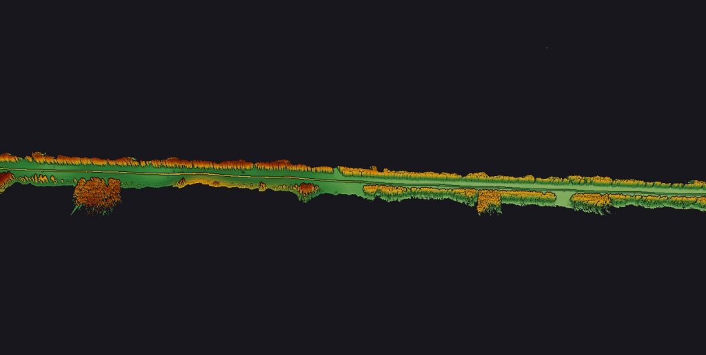
Longer stretch of powerlines, captured with clear definition of the surrounding vegetation and colorized by height.
Mission parameters
- Survey size: 5 x 20km stretch of powerlines (BVLoS)
- Duration: 2 days planning and site checking; 3 days to fly; 2 days to process
- Number of flights: 5
- Flight speed and altitude: 60-70m AGL at 21m/s
- Equipment used: Carbonix used their Volanti RPAS paired with the YellowScan Mapper+ OEM. POSPac was used to post-process using Auscors station data, while the YellowScan CloudStation was used to select flight lines for processing and apply precise strip adjustment.
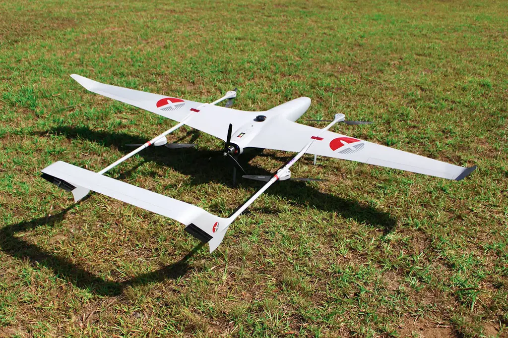
The Carbonix Volanti RPAS
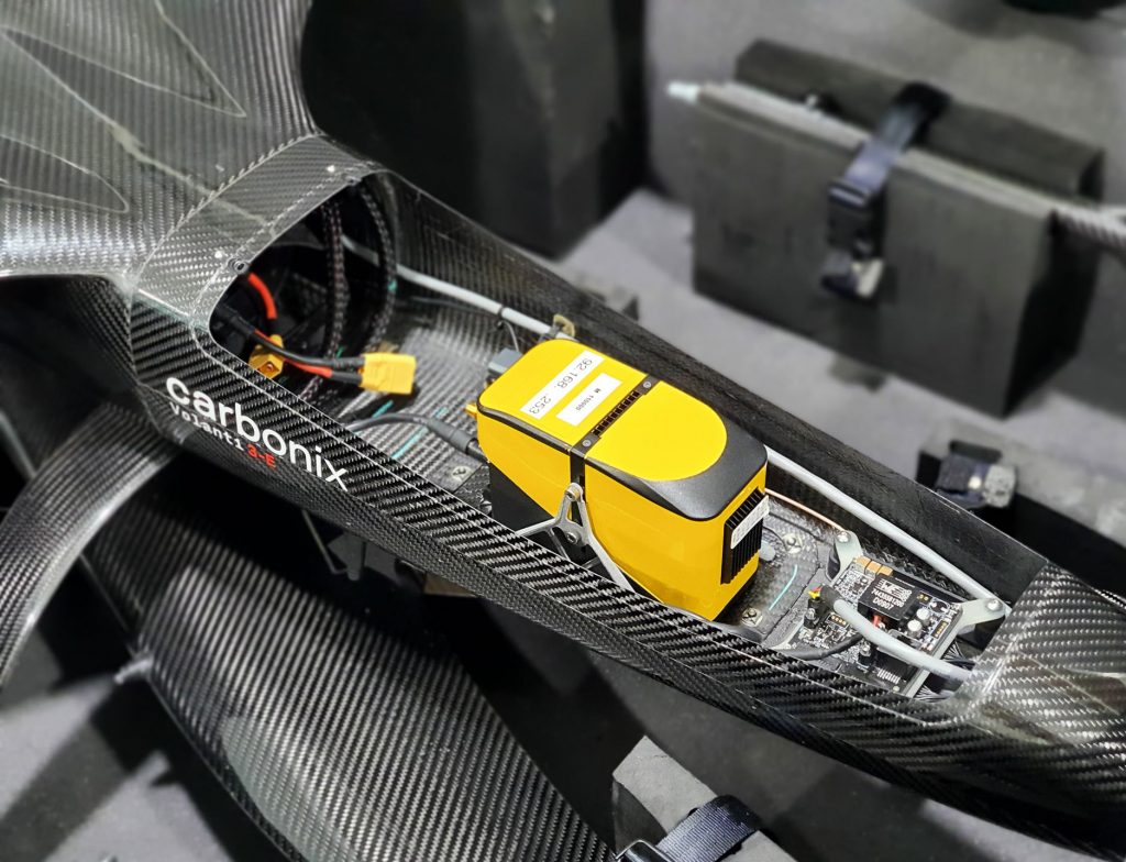
YellowScan Mapper+ OEM integrated in the Carbonix Volanti RPAS
Results
The data collected using the YellowScan Mapper+ OEM LiDAR system was highly valuable. The power lines were mapped with high accuracy and density, enabling smooth analytics. The vegetation was clearly delineated, enabling the utility company to deploy cutting teams precisely where needed. Furthermore, the data was post-processed using CORS base and strip aligned for optimal results.
Thanks to the insights derived from the LiDAR data, the power utility company could identify and address several areas of vegetation encroachment promptly. The digital twin generated from the data allowed for comprehensive modeling and analytics.
According to the Carbonix’s team the benefits of utilizing the Mapper+ LiDAR system included high data quality, user-friendly interface, rapid acquisition and processing speed.
They added that this LiDAR system accurately delineated small targets like powerlines and that the strip adjustment module in the YellowScan CloudStation worked effectively in minimizing level differentials.
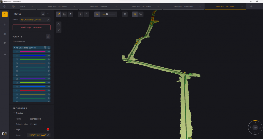
YellowScan CloudStation software suite with visible and clear distribution lines. Trajectory can be turned on or off and is off in this example to highlight the actual capture.
The Yellowscan Mapper+ OEM was an effective lightweight LiDAR system that enabled rapid scanning of power infrastructure in challenging terrain. We were able to turn around the point cloud quickly for our partners due to the simple yet powerful processing workflow. This allowed the client to make fast and informed decisions to protect their assets.

Cooper Wilks
Data Program Manager – Carbonix
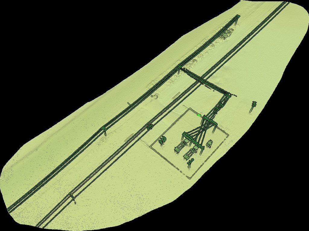
A pointcloud showing the level of detail. Small substation structures and connections are correctly aligned and relief off ground level is clear. The FOV of the scanner enabled dense point coverage of the length of the poles.
