Bathymetric Surveys Across Romania with YellowScan Navigator

Challenge
From coastal erosion to dam monitoring, bathymetric surveys in Romania come with a unique set of environmental and logistical challenges. In the Black Sea, water turbidity is high and GNSS signals are frequently unstable, conditions that typically hinder the accuracy of traditional bathymetric tools. Inland sites such as rivers and dams introduce their own complexities, including strong currents, steep embankments, or limited accessibility.
To gain the insights needed for infrastructure monitoring, archaeological research, and flood modeling, the surveying teams needed a solution that could perform in difficult environments while delivering high-quality, georeferenced 3D data.
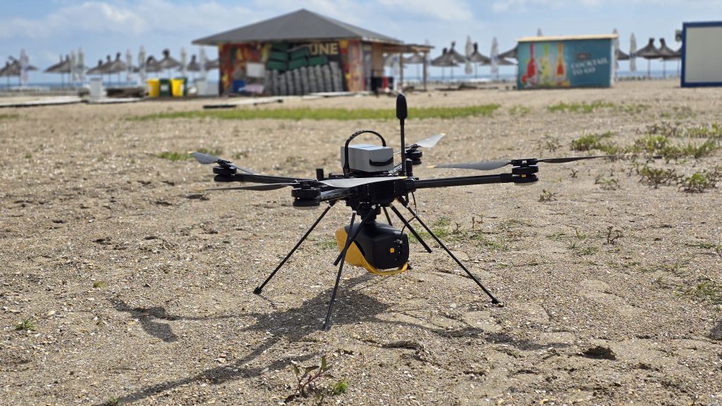
YellowScan Navigator, a topo-bathymetric LiDAR system, mounted on Tundra 2
Solution
Ciprian Iorga from La Orizont and Eduard Năstase from the National Institute for Earth Physics turned to a combination of YellowScan LiDAR systems to address these challenges. For underwater terrain mapping, they deployed the YellowScan Navigator, a UAV-based bathymetric LiDAR system designed to operate in shallow, turbid waters. To complement bathymetric data and capture full topographic coverage, the Surveyor Ultra (V2) and Vx20-300 were used on the same or adjacent sites, especially where dense vegetation or varied terrain required higher point density and precision.
Together, these systems enabled complete coverage, underwater and above ground, without compromising on data quality or mission efficiency.
There were three different missions:
1- Black Sea Coast (Mangalia – Venus Beach)
In this coastal monitoring project, the team focused on mapping erosion-prone areas, combining swamp, beach, shallow marine environment, and man-made infrastructure. Using the YellowScan Navigator, they were able to scan depths of up to 5–6 meters, even in high turbidity conditions. The resulting bathymetric data supported infrastructure planning and shoreline management.
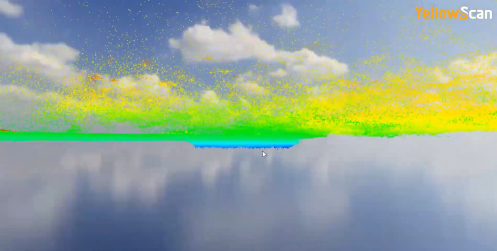
A visible sinkhole-like feature captured beneath the water surface using YellowScan bathymetric LiDAR.
Mission Parameters:
System Used:
- YellowScan Navigator
- YellowScan Vx20-300
Both were mounted on a Tundra 2 drone
Number of Flights:
- 8 flights with YellowScan Navigator
- 2 flights with YellowScan Vx20-300
Survey Area:
- Approximately 1 km², covering both land and water surfaces
Flight Parameters:
- Altitude: 80 meters
- Speed: 7 m/s
Mission Duration:
- Planning and data acquisition: ~8 hours (1 full working day)
- Data processing: ~24 hours
Post-Processing Software:
- YellowScan CloudStation and CloudCompare
2- Histria Ancient City
The primary objectives were to conduct archaeological mapping of submerged ruins and surface structures in the vicinity of a tumulus area. At this archaeological site, shallow water and significant GNSS signal disruption posed challenges for conventional survey methods. The Navigator provided usable bathymetric data despite these limitations, helping researchers uncover and interpret submerged structures of historical importance.
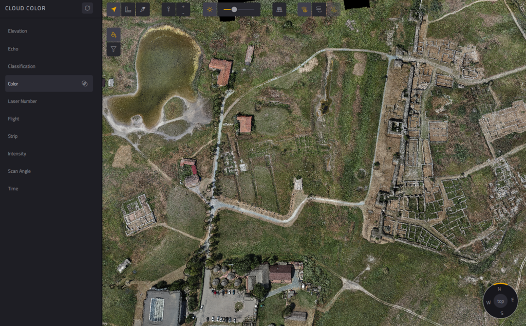
Colorized point cloud of the Histria ancient city processed in YellowScan CloudStation.
Mission Parameters:
Systems Used:
- YellowScan Navigator (mounted on Tundra 2)
- YellowScan Vx20-300 (mounted on Tundra 2)
- YellowScan Surveyor Ultra (mounted on DJI Matrice 300)
Number of Flights:
- 5 flights with Navigator
- 4 flights with Vx20-300
- 2 flights with Surveyor Ultra
Survey area:
- Approximately 0.5 km², covering the Ancient City of Histria, surrounding water bodies, swamp areas, and a tumulus zone
- Additionally, a ~20 km² area was flown for photogrammetric data acquisition as complementary information
Flight Parameters:
- Altitude: 80 meters
- Speed: 7 m/s
Mission Duration:
- Planning and data acquisition: approximately 2 full working days (including the extended photogrammetry flight)
- Data processing: approximately 24 hours
Post-Processing Software:
- YellowScan CloudStation and CloudCompare
3- Argeș River & Mihăilești Dam
This inland mission combined topographic and bathymetric LiDAR data to support flood modeling and monitor the structural integrity of the dam and surrounding riverbanks. The integration of aerial and bathymetric scans enabled comprehensive hydrological analysis and informed future infrastructure decisions, while also providing some archaeological information on an area near the river and covered by the survey.
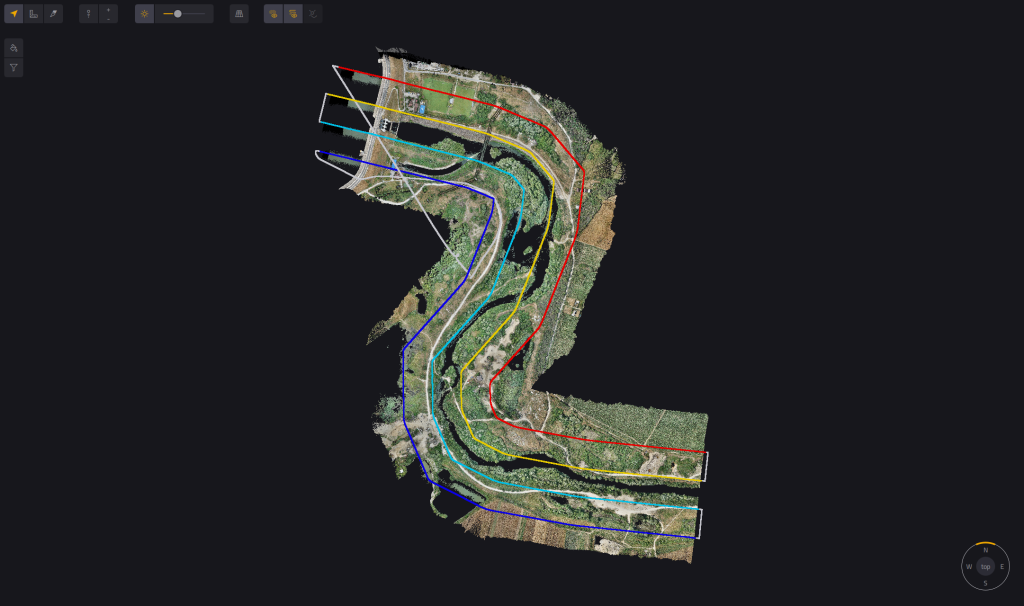
Colorized point cloud and flight plan of the dam.
Mission Parameters:
Systems Used:
- YellowScan Navigator
- YellowScan Vx20-300
Number of Flights:
- 4 flights with Navigator
- 2 flights with Vx20-300
Survey Area:
- Approximately 3.2 km²
Flight Parameters:
- Altitude: 80 meters
- Speed: 7 m/s
Mission Duration:
- Planning and data acquisition: approximately 8 hours (1 full working day)
- Data processing: approximately 24 hours
Post-Processing Software:
- YellowScan CloudStation and CloudCompare
Results
Through these missions, the teams demonstrated how UAV-based LiDAR can unlock high-accuracy data in areas that are traditionally difficult to reach or map. The YellowScan Navigator proved effective even in conditions of limited visibility and GNSS interference, delivering reliable bathymetric results. Meanwhile, the Surveyor Ultra and Vx20-300 provided dense, accurate topographic data to build complete digital terrain models.
By integrating their systems, La Orizont and the National Institute for Earth Physics successfully addressed diverse surveying needs, from cultural heritage preservation to flood risk assessment, highlighting the power and flexibility of multi-sensor UAV LiDAR workflows.
“Despite challenging water turbidity and GPS interference, the Navigator consistently delivered usable bathymetric data for infrastructure and archaeological analysis.

Acknowledgement
This work was supported by the National Research Program, project SOL4RISC no. PN 23360301
