Mapping Penguin Colonies in Antarctica

This penguin mapping project is part of an interdisciplinary expedition to Antarctica. This multimonth research expedition on a sailboat covered several themes: climatology, sociology of science, chemistry of microplastics, microbiology, biogeochemistry and ecology of penguins.
This last theme aims to map the breeding sites of the penguins. Lana Lenourry, a student researcher from Juste 2C, wanted to survey penguin nesting sites and map their distribution in this space according to abiotic and biotic parameters. For this, Lana needed to generate a digital terrain model on which we can locate and identify nesting penguins and distinguish between penguin species when they cohabit.
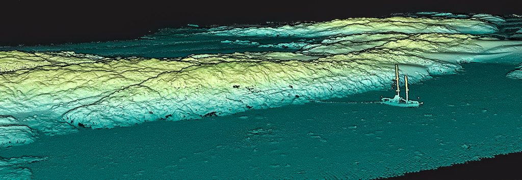
Point cloud from Mapper mounting on a DJI M300
What is the Challenge?
Accurate topographic data being scarce in Antarctica, Lana wanted to try to provide more data in this area, particularly in order to study the spatial distribution of penguins in their environment.
There are digital terrain models that have been generated by satellites that can give a global overview of the penguin habitat, however these models are not very accurate and there are artefacts. Other studies are carried out on land at sites frequented by scientists, but collecting such information is very time-consuming.
There are several objectives to this study:
– The first is to understand the relationship of penguins to the abiotic parameters of their environment. How they are distributed according to parameters such as slope, gully, proximity to the sea or glaciers…
Understanding how penguins occupy their space today could help anticipate the changes they will face, as with the pressures of climate change, their habitat is likely to evolve with the rise in sea level, retreat of glaciers, etc.
– A second objective is to understand how penguins are distributed according to biotic parameters.
Analyzing the spatial distribution of the different penguin species could help determine nesting trends according to the species studied and thus highlight potential competition for access to breeding spaces.
To our knowledge, this was the first time that a LiDAR drone survey has been conducted in Antarctica. The YellowScan Mapper has allowed us to quickly obtain a centimetric resolution of large surfaces which allowed us to accurately analyze and characterize the spaces occupied by penguins in relation to the available but unused ones.
We also hope that by making these digital terrain models available to the scientific community, they can facilitate the knowledge of the southern terrain. Indeed, having precise topography can facilitate the preparation phase of research campaigns (knowledge of the terrain before sampling for example).
The YellowScan Mapper camera module also helped us with the recognition of elements. This is an essential point for counting penguins, as the photos can be used to distinguish nesting penguins from non-nesting penguins. They can even be used to identify penguin species when they cohabit.
We received very good support from YellowScan, from getting trained on the CloudStation software, to handling the Mapper. The team was always there if there were any problems in the field, even on the other side of the world. Thank you very much!

Solution
The YellowScan Mapper used by Lana allowed for easy acquisition of the information needed for this research project. With the CloudStation license it was possible to check the data acquisition in the field directly after the flight. Moreover, with the YellowScan CloudStation, the processing and export to a digital terrain model (or DEM) was intuitive and fast.
The orthophoto acquisition can also be used to complete the information taken on the ground (particularly for species recognition).
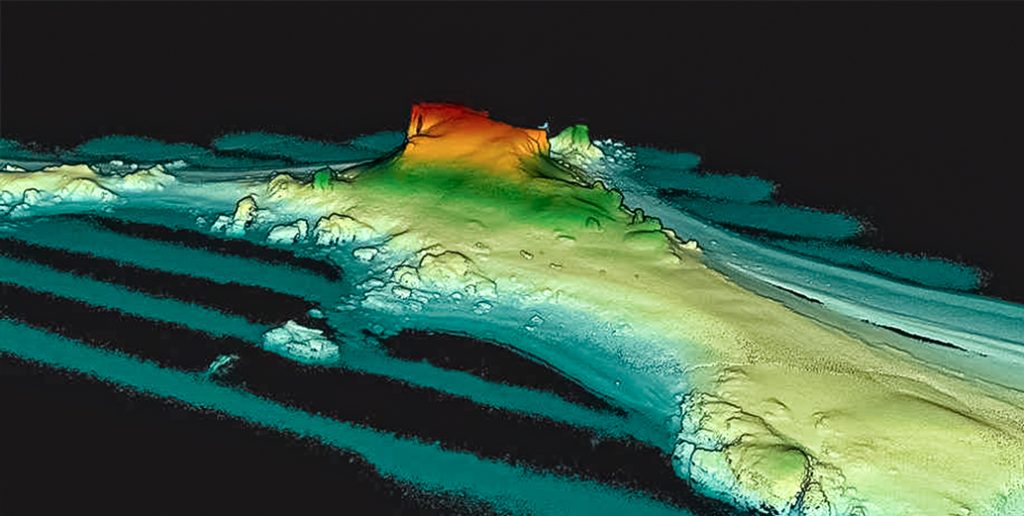
Pointcloud of one of the study areas
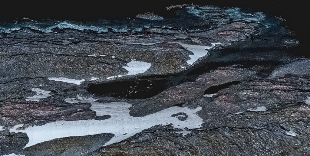
Colorized pointcloud from the mission
2022 © Photos & Pointclouds: Juste 2.0°C/Antarctica 2.0
