Introducing the YellowScan Navigator Bathymetric LiDAR system

Introducing the YellowScan Navigator: a groundbreaking bathymetric LiDAR System dedicated to coastal and river mapping from drones
Montpellier, France, January 4th, 2024 – YellowScan, a global leader and designer of the next generation of manned and unmanned LiDAR solutions, is thrilled to announce the release of its new bathymetric system, the YellowScan Navigator, at the world’s most powerful tech event – CES 2024.
We have all witnessed the impact of climate change: drier and warmer seasons, interspersed by heavy rains and flooding rivers. These environmental hazards have an impact on human activities and infrastructure. Precisely mapping both waterbed and land is mandatory for monitoring, modeling, and mitigating coastal erosion, flood hazards and understanding biodiversity habitats.
YellowScan has pioneered the LiDAR mapping from drones since 2012, offering precise instruments that have improved many surveyors’ day-to-day operation. YellowScan constantly aims at developing outstanding products that address the evolving needs of the market. This year, YellowScan is excited to introduce the YellowScan Navigator, dedicated to fulfilling the crucial need of surveyors to map underwater topography, in rivers, ponds and coastal areas.
I’m thrilled to see YellowScan Navigator addressing an unmet need in the mapping market and supporting society in tackling environmental challenges. As someone who started their career working on bathymetric LiDAR data, I’ve always pursued the vision of developing my own system. Mastering hardware design has enabled us to develop advanced processing algorithms and push the system’s performance beyond state-of-the-art.”
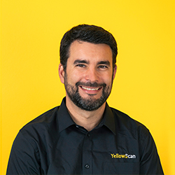
Tristan Allouis
Chief Technical Officer – YellowScan
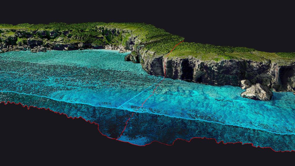
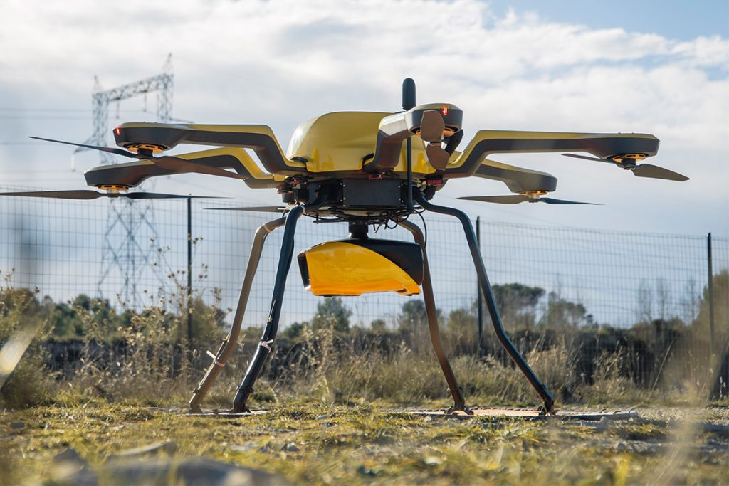
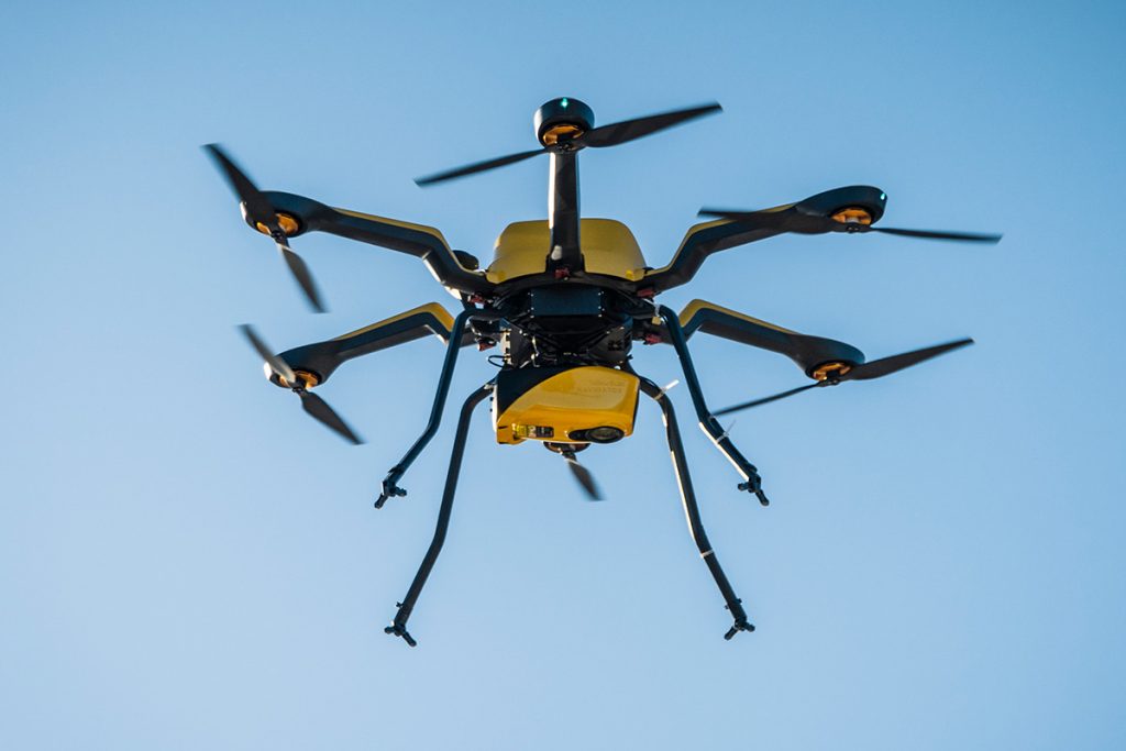
The YellowScan Navigator is an innovative bathymetric LiDAR solution. It features a laser scanner developed in-house over the last five years, and has been heavily tested to achieve optimal performance. This compact system is fine-tuned to map waterbeds within a depth range of 0 to 3 meters, but it reaches a depth of 18 meters in perfectly clear water conditions. It can be flown up to 100m above the water surface and provides measurements with a precision and accuracy of 3 centimeters. Additionally, a camera is embedded to provide true-color data colorization.
Dive into the future with Navigator!
Discover the product at CES 2024
Venue: Las Vegas Convention Center, Las Vegas, US
Booth No: Hall G – 61001-1, Eureka Park, Venetian Expo
Keynote Speech
Work with LiDAR: Unleashing its power in every form
Speaker: Tristan Allouis, CEO at YellowScan
Date: Friday, January 12th
Time: 10:00am – 10:20am (PTZ)
Location: Pavillon France
Where to meet us after the show
Join the future of bathymetric mapping with the YellowScan Navigator and enhance your underwater insights during the YellowScan LiDAR Convention from April 17th to 19th in the South of France.
Head to this page for more information.
About YellowScan
At YellowScan we design, develop, and build our UAV LiDAR solutions to exceed the expectations of professionals that require performance, robustness, and accuracy. Our complete hardware and software solutions are easy to use data collection tools coming with an unparalleled level of training and support from our experts.
Founded in 2012, YellowScan has customers around the world, and its products are used in surveying, forestry, environmental research, archaeology, industrial inspection, civil engineering, and mining sectors.