What was the challenge?
L’Avion Jaune and Ginger CEBTP, a geotechnical study office, were mandated by the Departmental Council to conduct a risk assessment study of rockfall hazards on their road networks. The end goal was to implement the most suitable prevention measures to protect road users.
The natural degradation of limestone cliffs generates landslides and block falls that can mobilize large volumes of material and impact the road networks below.
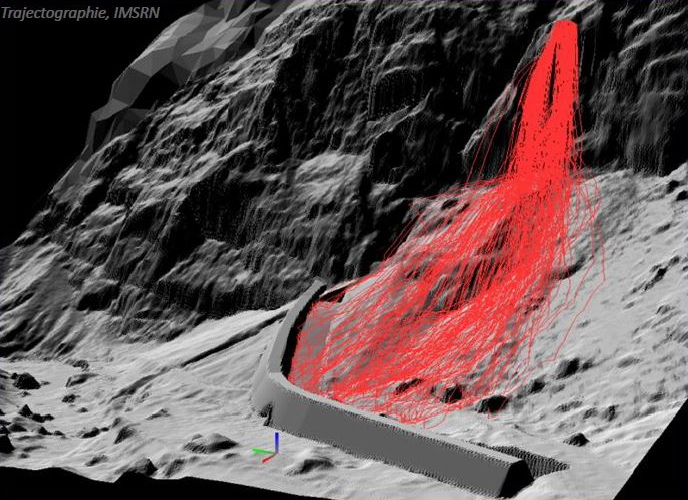
The management of this risk was mainly based on trajectographic analysis, which consisted in simulating the fall of rock masses from the peaks to the bottom of the valley. The aim was to evaluate the level of risk incurred and to optimize the dimensioning and implementation of rockfall barriers. To conduct this risk mitigation, a 3D model study of the cliffs overhanging a frequented road was essential. The site was 200 m (655 ft) high, 300 m (980 ft) wide and 2.5 km (1.5 mi) long.