LiDAR for Drones: Everything you need to know about LiDARs on UAVs

What is a LiDAR for drones?
In the realm of modern technology, LiDAR (Light Detection and Ranging) has emerged as a ground breaking innovation, particularly when combined with drones. This fusion empowers industries to redefine data acquisition, mapping, and analysis. Let’s take a closer look at LiDAR for drones and see how this dynamic pairing is reshaping our perspective of the world.
Understanding LiDAR Technology
LiDAR operates by emitting laser pulses and precisely measuring the time taken for these pulses to return after interacting with surfaces. This core principle forms the foundation for LiDAR’s ability to construct 3D maps of the environment. By leveraging this measurement, LiDAR systems can accurately determine distances, making them pivotal for tasks such as object detection, spatial analysis, and terrain modeling. Check out our article on How Does LiDAR Work.
A quick focus on Drones
Unmanned Aerial Vehicles (UAVs), commonly known as drones, have rapidly evolved into essential tools across many industries. Their capacity to access remote or hazardous regions, capture aerial imagery, and gather data with exceptional accuracy has revolutionized numerous sectors. Drones possess the flexibility to accommodate various payloads, including cameras, sensors, and LiDAR solutions. This adaptability makes them an ideal platform for integrating LiDAR technology, expanding their utility beyond traditional aerial imaging. Finding the right drone for LiDAR mapping can be tough, but this article has all the advice you need.
Why are LiDARs and drones so commonly used together?
When LiDAR joins forces with drones, it brings a variety of benefits that push industries into new possibilities:
- Unrivaled data collection: LiDAR-equipped drones rapidly cover large areas, capturing intricate details that might be challenging with conventional methods. This efficiency leads to detailed data that’s ready for analysis and informed decisions.
- Precision elevated: The combination of LiDAR’s precise distance measurement with the agility of drones enables high-precision data collection. This precision is a game-changer for industries like surveying, where measurements accurate to the centimeter level are essential.
- Versatile deployment: Whether monitoring construction sites, evaluating agricultural landscapes, or conducting archaeological surveys, drones with LiDAR sensors adapt easily to lots of applications. Their versatility boosts the efficiency and scope of these projects.
- Exploring hard-to-reach places: Drones can go where it’s tough or dangerous for people to go. LiDAR’s ability to penetrate through vegetation is really helpful for checking the environment and after disasters.
- Mapping revolutionized: Traditional methods of mapping demanded extensive ground work. But now drones equipped with LiDAR can quickly get elevation data, infrastructure nuances, and more. The result? Faster, better maps.
- Efficiency redefined: When LiDAR technology is coupled with drones, no need to spend as much time doing surveys on the ground, and people don’t have to be in risky situations as much. This saves time, there is less money spent, and everyone is safer.
The combination of LiDAR and drones changes how industries approach data acquisition, analysis, and mapping. LiDAR’s distance measurements with drones’ aerial perspective make a strong team that changes how we see things. If you’re curious, check out this article on 6 things to consider for good UAV LiDAR integration.
As we keep going in this article, we’ll dig into the technical details of how LiDAR works with drones. We’ll also learn about the different industries that use this combination and how to pick the right LiDAR setup for specific needs.
LiDAR on drones, how does it work?
When LiDAR and drones work together, they create something quite impressive that goes beyond the surface. Taking a closer look at how LiDAR works on drones reveals a process that uses precision, innovation, and adaptability.
The main challenges LiDAR encounters with drones
While drones with LiDAR have a lot of possibilities, they also face some challenges that come from their unique combination:
- Vibration and stability: Drones are dynamic platforms and are subject to vibrations and movements. These can compromise LiDAR measurements and data accuracy. Ensuring stable and calibrated equipment is crucial to overcome this challenge.
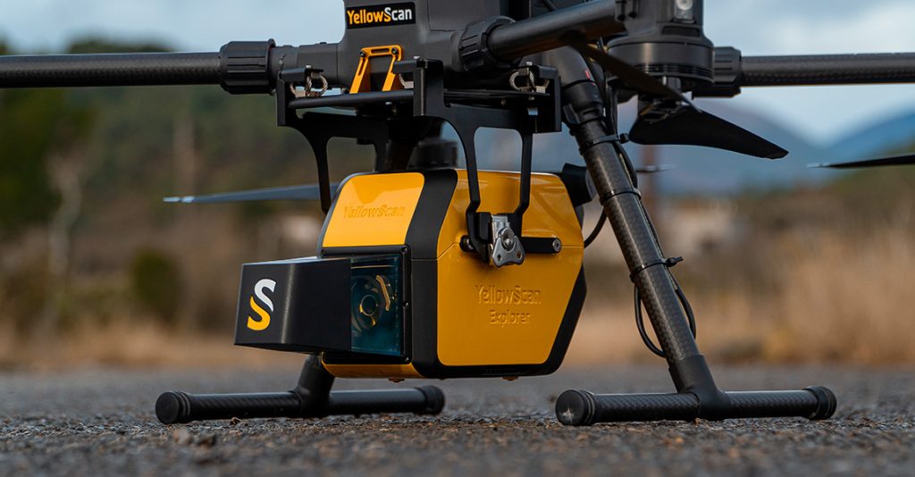
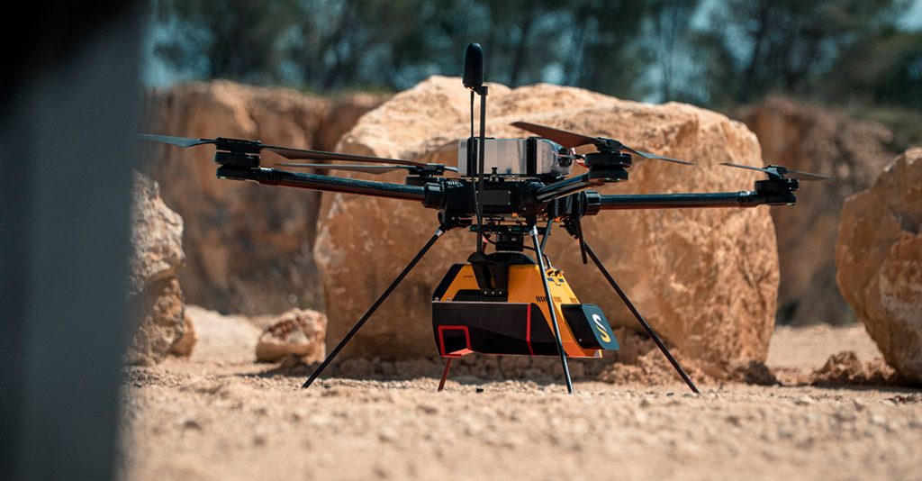
- Payload and power management: Integrating LiDAR onto drones requires careful consideration of payload capacity and power consumption. Some LiDAR models can be bulky and energy-intensive, affecting flight durations and manoeuvring capabilities.
- Data processing: LiDAR generates large amounts of data in the form of point clouds. Turning this data into usable information needs a lot of computer power and specialized software.
- Limited range and resolution: Drones can reach places others can’t, but their flight range and altitude might limit how much LiDAR data they collect and the level of detail. To tackle this, strategic flight planning is essential.
Solutions for these problems
Innovations in both LiDAR technology and drone engineering have paved the way to address these challenges:
- Vibration dampening: Advanced stabilization systems and dampening mechanisms prevent drone vibrations. These innovations ensure accurate LiDAR measurements, even in dynamic flight conditions.
- Miniaturization and efficiency: Ongoing efforts to make LiDAR sensors smaller have led to compact, lightweight options with lower power requirements. This allows them to be integrated to drones without sacrificing drone performance.
- Real-time data processing: The evolution of onboard data processing allows LiDAR-equipped drones to process data in real time. This capability streamlines data acquisition and minimizes post-flight processing works.
- Coupling with other sensors: Drones now combine LiDAR with other sensors, such as cameras and GNSS equipment, to enhance data accuracy and spatial awareness. This combination offers a holistic view of the environment.
- Advanced flight planning: Drone software has evolved to incorporate LiDAR-specific flight planning. This enables optimized routes, altitude adjustments, and overlap configurations to maximize data coverage.
LiDAR and photogrammetry: what’s the difference?
In the world of remote sensing and geospatial data acquisition, LiDAR and photogrammetry stand as two important tools, each offering unique insights into our world. These methodologies work together, event though they come from different ideas, use distinct sensors, and present varying applications. Let’s explore LiDAR and photogrammetry in more detail, to see their differences, synergies, and the landscapes they map.
Understanding LiDAR and Photogrammetry
LiDAR: The laser-powered insight
As mentioned earlier, LiDAR employs laser technology to measure distances. Mounted on platforms such as UAVs, LiDAR sensors emit laser pulses toward the earth’s surface. The sensor then measures the duration it takes for the laser to bounce back, thereby calculating the distance to the target. The result is a dense point cloud—a collection of spatially referenced points that collectively represent the environment’s surface.
Photogrammetry: The visual insight
Photogrammetry, on the other hand, uses the power of imagery. By capturing overlapping photographs from different angles, a process called “stereo imaging,” photogrammetry derives measurements and creates 3D models. Specialized software analyzes the parallax between corresponding points in the images, accurately calculating their positions in 3D space. These points, when connected, form a point cloud, which is then used to generate detailed models, maps, and reconstructions.
The points of distinction
Sensors:
LiDAR employs laser sensors that emit and measure light pulses. This direct distance measurement allows LiDAR to capture accurate and precise elevation data, making it a preferred choice for elevation modeling and terrain mapping.
Photogrammetry utilizes conventional cameras to capture images. While it may not provide the precision of direct distance measurement, it compensates by offering detailed visual information. This makes it ideal for industries where capturing visual details is crucial, such as cultural heritage documentation and architectural modeling.
Point clouds and mapping:
LiDAR generates point clouds by capturing thousands of laser measurements per second. These dense point clouds facilitate accurate mapping, especially in areas with complex topography or dense vegetation. LiDAR excels in scenarios where elevation accuracy is critical, such as flood modeling, forestry management, and infrastructure planning.
Photogrammetry’s point clouds result from image-based calculations. These point clouds are typically very dense and offer photorealistic textures and visual richness. However, they do require even more computing power and a great storage scheme. This makes photogrammetry a tool of choice for industries where visual representation is crucial, like virtual tourism, movie production, and architectural visualization.
UAV integration:
Both LiDAR and photogrammetry work well with drones, making it easier for data acquisition. LiDAR equipped UAVs are great for terrain analysis, forestry management, and power line inspections. Photogrammetry equipped UAVs excel at creating 3D models of structures, capturing urban landscapes, and archeological documentation.
Applications and synergies:
LiDAR and photogrammetry are not mutually exclusive; they complement each other. In fact, some applications benefit from their combined use. For example, forestry management could utilize LiDAR’s precise elevation data along with photogrammetry’s visual details to assess tree health and species distribution.
In conclusion, LiDAR and photogrammetry are two distinct yet interconnected tools in the world of geospatial data acquisition. LiDAR is an active sensor that emits its own light. Photogrammetry is a passive method, requiring a third-party light source. Deciding between them depends on what the project needs and what you want to achieve. Whether you need accurate elevation mapping with LiDAR or visually rich reconstructions with photogrammetry, both ways have their own strengths.
In the following sections, we’ll explore how LiDAR for drones are used in different areas like archaeology, mining, and construction engineering. We’ll see how LiDAR equipped drones can revolutionize these fields.

Exploring LiDAR for Drone applications
Revolutionizing archeology with LiDAR-equipped UAVs
The integration of LiDAR sensors with drones sparked a big change in archeology. Traditional excavation methods often present challenges in preserving historical sites and capturing comprehensive data. But now, LiDAR-equipped UAVs are leading the way in new archeological discoveries.
These drones fly above ancient landscapes, emitting laser pulses that show hidden terrain contours and architectural remains. The precision of LiDAR measurements maps out details invisible to the naked eye, allowing archeologists to reconstruct ancient structures, discover complex patterns, and uncover clues about civilizations from long ago. From remote sensing to preserving fragile sites, LiDAR-equipped drones go beyond time, connecting us to our ancestral heritage in new and surprising ways. Learn how LiDAR has been used to trace the footsteps of pirates: revealing their presence in the Indian Ocean.
Boosting mining operations through accurate data collection
The mining industry is right at the edge of big changes, thanks to LiDAR-equipped drones. In mining, accurate data is synonymous with success, and these drones contribute to enhanced efficiency, safety, and sustainability.
LiDAR for drones perform detailed topographic surveys of mining sites, capturing high-resolution elevation data and detecting even subtle changes in terrain. This data guides site planning, resource management, and environmental impact assessments. The ability to monitor stockpiles, assess slope stability, and calculate volumetric measurements empowers mining operations with unparalleled insights. By minimizing human intervention in hazardous zones and optimizing resource allocation, LiDAR-equipped drones elevate mining to new heights of precision. To find out more, discover how YellowScan solutions are used to map coal stockpile in Ukraine.
Transforming construction engineering via high-precision mapping
LiDAR-equipped drones redefine the way construction sites are surveyed, mapped, and managed.
LiDAR for drones rapidly capture detailed 3D data of construction sites, enabling high-precision mapping of terrain, structures, and utilities. This real-time insight guides construction progress monitoring, clash detection, and site analysis. The integration of LiDAR and Building Information Modeling (BIM) streamlines workflows, enhances collaboration and mitigates errors. From site preparation to project completion, LiDAR-equipped drones empower construction engineers to optimize resources, reduce costs, and deliver projects on schedule. Learn how LIDAR has been used to build the digital twin of the Chain Bridge in Budapest.
The above examples merely scratch the surface of the potential that LiDAR-equipped drones bring to various industries. In the following sections, we’ll talk about what to consider when selecting the perfect LiDAR solution. The survey size, terrain, precision needs, and drone compatibility need to be considered to choose the right LiDAR solution.
How to choose the perfect LiDAR solution?
Matching survey size, terrain, and flying parameters
To the ideal LiDAR solution, you’ll need to have a clear understanding of your project’s unique characteristics. Survey size, terrain complexity, and flying parameters are important factors that influence the effectiveness of LiDAR-equipped drones.
For large surveys, a LiDAR model with extended range capabilities becomes essential. Diverse terrain necessitates adaptable systems capable of penetrating dense vegetation or capturing details in urban environments. Flying parameters, including field of view (FOV) and flying height, dictate the resolution and coverage of collected data. By bringing together these factors, you ensure the captured data aligns with your project’s scope. All LiDAR solutions are different, and it can be difficult to determine which one best meets the needs of a project. However, you can get an initial overview of our product range by filtering and comparing our sensors here.
Tailoring precision and accuracy to project requirements
Precision is essential in any attempt involving LiDAR technology. Each project demands a specific level of accuracy, which translates into choosing a LiDAR system with an appropriate range, pulse rate, and scan frequency. Systems offering high accuracy cater to needs requiring intricate details, while projects with broader survey requirements can opt for systems with lower accuracy but higher range. Precision, after all, isn’t a one-size-fits-all proposition—it’s a tailor-made requirement.
Understanding point density and its significance
Point density, the number of Lidar measurements collected per unit area, is a metric that profoundly impacts data quality. Higher point density yields a more comprehensive representation of the environment. This metric directly influences the clarity of captured details, making it particularly crucial for industries like forestry analysis, power line inspections, and topographic mapping.
Assessing LiDAR compatibility with drones platforms
Compatibility between Lidar sensors and drone platforms ensures seamless integration and optimal performance. Not all drones can accommodate every Lidar model. It’s imperative to assess payload capacity, power requirements, and the ease of integration with the chosen drone. Widely-used drone platforms like DJI M300 or DJI M600, equipped with adaptable mounting options, provide a versatile foundation for Lidar integration.
Evaluating compatibility extends beyond hardware—it encompasses software as well. Lidar data processing software should harmonize effortlessly with your chosen drone platform. This harmony streamlines data collection, processing, and analysis, ensuring a unified workflow from aerial data capture to actionable insights.
Accessing Training and support to get started
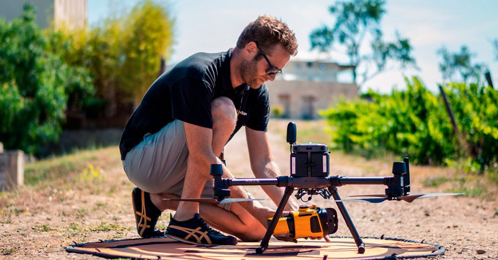
Embarking on the journey of integrating LiDAR in your survey work is a big step towards precision and innovation. But it might be a bit tricky at first as you learn how it all works. Getting good training and support is really helpful on this journey.
Learning the ropes of LiDAR
LiDAR, with its laser-based sensor capabilities and high-precision scanning, needs a basic understanding. it’s important to learn about its principles, data interpretation, and nuances. You can start by taking online courses, attending workshops, or going to seminars focused on LiDAR and surveying. These resources teach you everything from data processing to best practices for optimal results. Check out our YellowScan LiDAR Convention, an event that focuses on the trends that will shape tomorrow’s companies by covering a variety of topics ranging from the advantage of using LiDAR to what to expect for this market in the next few years.
Guided training for effective surveying
To ensure you’re equipped to use LiDAR effectively, guided training sessions are really helpful. Lots of manufacturers offer training programs for their LiDAR products. These sessions cover everything from hardware setup and sensor calibration to data collection and post-processing.
Support beyond the training
When you’re in the field, you still need help and support. As you come across real-world problems, you might have questions about optimizing sensor settings, enhancing data accuracy, or troubleshooting issues. Strong support systems from manufacturers and industry experts are like a lifeline, giving you quick help and guidance when you need it. Manufacturers and experts can help you with this through customer service or online communities.
Transforming learning into expertise
As you advance in your training and gain practical experience, your transition from learning to becoming an expert is a transformative process. Applying your training in the field, refining scanning techniques, and understanding how to translate data into meaningful 3D models lead to becoming a skilled LiDAR surveyor.
In essence, accessing training and support is like adding another layer of precision to your LiDAR work. Learning the nuances of the methodology, guided by training programs, gives you the ability to optimize data acquisition and scanning techniques. Additionally, having a support system that quickly addresses challenges ensures that problems are resolved, creating an environment where learning and progress can thrive continuously.
As technology evolves, the options for LiDAR solutions expand to meet various needs. By carefully considering factors like the survey size, terrain characteristics, precision requirements, point density needs, and compability factors, you can choose the LiDAR solution that best fits your project objectives.
LiDAR for Drone cost: deciphering investment factors
The financial aspect of integrating Lidar with drones is a vital consideration. Various components contribute to the cost of a Lidar for drone system, and understanding these factors aids in making informed investment decisions.
What defines the price of a drone LiDAR solution?
A drone LiDAR system’s price is influenced by its technical specifications, including range, accuracy, and point density capabilities. High-performance systems are at a higher price due to their precision and advanced features. The integration complexity, including installation and calibration, also contributes to the overall cost.
Essential factors influencing investment decisions
Investment decisions depend on a project’s scope, specific requirements, and long-term goals. Finding the right balance between precision needs against budget constraints is really important. For projects requiring millimeter-level accuracy, investing in higher-end solutions is justified. However, for applications where broader accuracy is enough, cost-effective options may be more suitable.
Evaluating long-term benefits is equally important. LiDAR-equipped drones streamline workflows, reduce labor costs, and enhance data quality. This efficiency translates into substantial returns on investment over the years.
As we unravel the cost considerations, we step closer to understanding the holistic impact of Lidar-equipped drones on project efficiency, accuracy, and profitability. The intricate interplay between investment and benefits shapes decisions that not only optimize budgets but also fuel innovation and growth. As we look at the costs, we get a better idea of how LiDAR-equipped drones can make projects more efficient, accurate, and profitable. Figuring out how much you spend versus what you gain helps make choices that save money and also help you grow.
LiDAR for drone: FAQ
Answering frequently asked questions sheds light on the world of LiDAR-equipped drones, providing insight into what they can and cannot do.
What is the Range of a LiDAR for Drone System?
LiDAR for drone systems operate at varying ranges, which are determined by their technical specifications. High–end sensors can reach several hundred meters, whereas more budget friendly options cover shorter distances. The range will depend mainly on the integrated sensor and may vary according to the different LiDAR integrators (such as GeoSLAM, Topodrone, YellowScan, etc.).
Can I Process LiDAR Data with Existing Software?
LiDAR data processing software varies based on system specifications. Many systems offer proprietary software, while others support integration with widely used platforms for streamlined data processing. Check out our YellowScan CloudStation software.
Are LiDAR for Drones Only for Large-Scale Projects?
LiDAR-equipped UAVs are not limited to large-scale projects. These versatile tools can efficiently map various areas. Recent advancements, such as DJI’s integration of LiDAR technology, have democratized its usage. Whether surveying small zones or larger ones, these UAVs can generate detailed point cloud maps, enhancing the accuracy of geospatial information. This democratization has revolutionized how LiDAR and UAVs combine to capture topographical data, making it accessible beyond traditional projects.
Can LiDAR for Drones Penetrate Vegetation?
LiDAR’s ability to penetrate vegetation depends on a system’s specifications and the number of echoes. Higher wavelengths are more effective at penetrating dense foliage, making them suitable for forestry applications.
What is PPK correction?
PPK stands for “Post-Processed Kinematic.” It’s a technique used in the field of surveying, geodesy, and remote sensing, particularly in the context of Global Navigation Satellite Systems (GNSS) technology, such as GPS (Global Positioning System) and other satellite-based navigation systems.
PPK involves collecting raw GNSS data from a receiver on a moving platform, such as a drone or a surveying instrument. Unlike Real-Time Kinematic (RTK) positioning, where corrections are applied in real-time, PPK data is collected without applying corrections during data acquisition. Instead, these corrections are applied later during post-processing.
In the post-processing phase, the collected GNSS data is combined with correction data from a reference station or base station with known coordinates. This correction data helps to enhance the accuracy of the GNSS measurements by compensating for errors caused by atmospheric conditions, satellite orbits, and other factors. By comparing the raw data to the corrected data, PPK can achieve high levels of positional accuracy.
PPK is widely used in various industries, including surveying, mapping, agriculture, and drone-based uses. It allows for accurate positioning without the need for real-time communication with a reference station, making it particularly useful in remote or challenging environments where real-time corrections might not be readily available.
Final thoughts & conclusion
The journey through the LidDAR-equipped drones’ world unveils a tapestry of innovation, precision, and transformation. This convergence of LiDAR technology and aerial platforms transcends boundaries, enhancing data acquisition, refining accuracy, and reshaping industries.
From revolutionizing archeology to optimizing mining operations and streamlining construction engineering, the applications are vast. Navigating the complexities of LiDAR solutions ensures optimal outcomes tailored to each project’s needs.
While cost considerations play an essential role, the investment extends beyond financial aspects. LiDAR-equipped drones symbolize an investment in efficiency, accuracy, and growth.
In the ever-evolving partnership between LiDAR and drones, the journey continues. With each flight, each scan, and each application, the possibilities expand, forging a future where innovation soars and insights know no bounds.
Enjoy the article? Get the latest LiDAR news and insights in your inbox by subscribing to our newsletter today!
References
- Neonscience – “The Basics of LiDAR”: Website:
https://www.neonscience.org/resources/learning-hub/tutorials/lidar-basics - USGS 3DEP Program – “3D Elevation Program”: Website: https://www.usgs.gov/core-science-systems/ngp/3dep
- Quentin Pentek – “Contribution to the generation of 3D-color maps of natural environments using data from a drone multisensor system“: Website:
https://www.theses.fr/2020MONTS037 - University of Vermont – “Vermont Center for Geographic Information”: Website: https://vcgi.vermont.gov/resources/frequently-asked-questions/general-mapping-faqs
- National Oceanic and Atmospheric Administration (NOAA) – “LiDAR 101”: Website:
https://coast.noaa.gov/data/digitalcoast/pdf/lidar-101.pdf - Wikipedia – “Lidar”: Website:
https://en.wikipedia.org/wiki/Lidar