LiDAR for Ecological Restoration: YellowScan in Action

Challenge:
L’Avion Jaune, a company specialized in the production of earth observation data (multispectral imagery and LiDAR), is well known by key players in geomatics and environmental management in France.
They took part in a study to model the hydrographic network and the hydraulic functioning of a wetland, within a nature reserve in New Aquitaine, France. The hydraulic modeling will facilitate the identification of development possibilities for restoration or functional improvement. The aim is to improve wetland resilience to the impacts of climate change.
Solution:
L’Avion Jaune organized LiDAR data acquisitions to establish the micro-topography of the location in order to detect the hydrographic network in a very complex environment, including drainage ditches and a network of ponds.
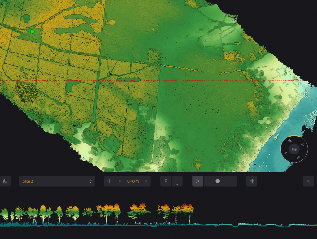
In this nature reserve, the hydrographic network was hidden beneath the forest canopy or the dense herbaceous vegetation characteristic of wetlands. Typically, the available national data (RGE Alti, LiDAR HD) don’t always allow it to be identified. They therefore needed a specific and more accurate LiDAR survey, with many echoes and a higher density of points to acquire a DTM of the best possible quality.
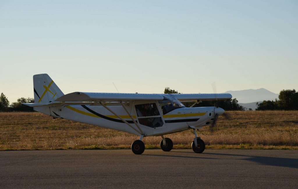
For this project, L’Avion Jaune used the YellowScan Voyager to map about 1000 hectares (2500 acres) of dense forest and wetlands, and to produce a digital terrain model (DTM). As UAVs have certain limitations, especially in terms of regulations, they wanted a LiDAR solution to carry on board their light aircraft. They selected the Voyager for this project based on its high point density, long range, and rapid acquisition speed. Its 15 return echoes were ideal for this study as it helped optimize the vision under the vegetation and the restitution of the hydrographic network.
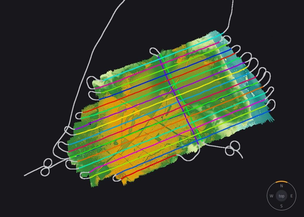
Flight plan based on turns and flight line interceptions
Parameters:
- Survey size: 1000 ha (2500 acres)
- Duration: 1.5 hours flight time for acquisition, 3 days processing (POSPac, SA, DTM, Quality control)
- Number of flights: 2 flights
- Flight #1: 11 East/West axes
- Flight #2: 7 East/West axes + 2 North/South axes
- Flight speed and altitude: 30 m/s at 200 m (650 ft) AGL
- Equipment: Travel on light aircraft (ICP Savannah S)
- Software: YellowScan CloudStation with Strip Adjustment and Terrain Modules
- LiDAR system: YellowScan Voyager
Results:
- Point density: 100 pts/m² with 20 pts/m² in ground class
- Accuracy: Average dz = 1 cm, Root mean square = 5 cm (GCP on natural terrain).
The deliverables were for an environmental study: DSM, DTM & DEM at 50 cm resolution.
With this LiDAR solution mounted on board their light aircraft, they collected 100 pts/m² in less than 2 hours.
The results promoted the understanding of the hydraulic functioning of a complex natural environment combining dense forest and wetland with its network of thousands of ponds. According to L’Avion Jaune, the YellowScan Voyager opened up new horizons for mapping large areas faster.
The ease of integration on our light aircraft, the simplicity of use and the qualities of the Voyager (15 echoes, high point density and comfortable operating height) allow us to offer surveys over large and complex areas (dense forest in particular) with an amazing DTM quality